San Jose geodata
San Jose (Eastern Visayas) is a seat of a third-order administrative division; located in Philippines in Asia/Manila (GMT+8) time zone. In our database, there are 4166 cities with bigger population. Compared to other cities in Philippines, 55.1% of cities are located further ↓South; 78.7% of cities are located further ←West and 95.5% of cities have higher elevation than San Jose. Note1
Administrative division(s):
- Level 1: Eastern Visayas
- Level 2: Province of Northern Samar
- Level 3: San Jose


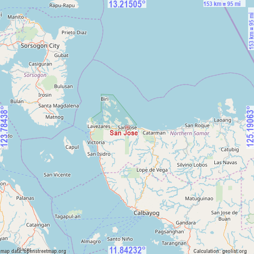
San Jose GPS coordinates[2]
12° 31' 46.56" North, 124° 29' 15" East
| Map corner | latitude | longitude |
|---|---|---|
| Upper-left | 13.21505°, | 123.78438° |
| Center: | 12.5296°, | 124.4875° |
| Lower-right: | 11.84232°, | 125.19063° |
| Map W x H: | 152.6×152.6 km | = 94.8×94.8mi |
| max Lat: | 20.78733° ⇑44.9% North |
| San Jose: | 12.5296° |
| min Lat: | ⇓55.1% South 4.65442° |
| min Long | San Jose | max Long |
| 117.04868° | 124.4875° | 126.58417° |
| W 78.7%⇐ | ⇒21.3% E |
Elevation
Elevation of San Jose is 5 m = 16 ft, and this is 82.9 m = 272 ft below average elevation for this country.
| Max E: |
2262 m = 7421 ft | 95.5% |
| Avg. | 87.9 m = 288 ft | |
| San Jose | 5 m = 16 ft | |
Min E: |
-2 m = -7 ft | 4.5% |
See also: Philippines elevation on elevation.city.
Geographical zone
San Jose is located in North Torrid zone (between Equator and Tropic of Cancer). Distance of this Northern Tropic circle is 1212.8 km =753.6 mi to North.| Distance of | km | miles | from San Jose |
|---|---|---|---|
| North Pole | 8613.9 | 5352.4 | to North |
| Arctic Circle | 6008 | 3733.2 | to North |
| Tropic Cancer | 1212.8 | 753.6 | to North |
| Equator | 1393.2 | 865.7 | to South |


Nearby cities:
15 places around San Jose: (largest is in red/bold)
• Alegria
22.8 km =14.2 mi,  230°
230°
• Allen
22.2 km =13.8 mi,  261°
261°
• Biri
21.7 km =13.5 mi,  321°
321°
• Bobon
8.3 km =5.2 mi,  93°
93°
• Catarman
16.7 km =10.4 mi,  101°
101°
• Cervantes
25.9 km =16.1 mi,  133°
133°
• Erenas
21.3 km =13.2 mi,  236°
236°
• Jubasan
22.3 km =13.9 mi, 256°
• Lavezares
17 km =10.6 mi,  271°
271°
• Makiwalo
23.8 km =14.8 mi, 95°
• Polañge
21.5 km =13.4 mi, 133°
• Rosario
6.8 km =4.2 mi, 263°
• San Antonio
26.1 km =16.2 mi, 240°
• San Isidro
23.1 km =14.4 mi, 227°
• Victoria
21.2 km =13.2 mi, 244°
Sources, notices
• [Note1] Compared only with cities in Philippines existing in our database
• [Src1] Map data: © OpenStreetMap contributors (CC-BY-SA)
• [Src2] Other city data from geonames.org with taken over terms of usage.
• [Src3] Geographical zone / Annual Mean Temperature by Robert A. Rohde @ Wikipedia
