Chambrey geodata
Chambrey (Western Visayas) is a populated place; located in Philippines in Asia/Manila (GMT+8) time zone. With population of 3,108 people, there are 2411 cities with bigger population in this country. Compared to other cities in Philippines, 57.1% of cities are located further ↑North; 56.3% of cities are located further ←West and 67.4% of cities have higher elevation than Chambrey. Note1
Administrative division(s):
- Level 1: Western Visayas
- Level 2: Province of Negros Occidental
- Level 3: Manapla


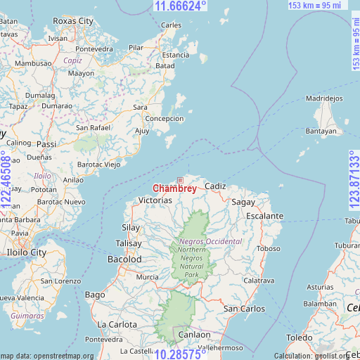
Chambrey GPS coordinates[2]
10° 58' 36.48" North, 123° 10' 5.52" East
| Map corner | latitude | longitude |
|---|---|---|
| Upper-left | 11.66624°, | 122.46508° |
| Center: | 10.9768°, | 123.1682° |
| Lower-right: | 10.28575°, | 123.87133° |
| Map W x H: | 153.5×153.5 km | = 95.4×95.4mi |
| max Lat: | 20.78733° ⇑57.1% North |
| Chambrey: | 10.9768° |
| min Lat: | ⇓42.9% South 4.65442° |
| min Long | Chambrey | max Long |
| 117.04868° | 123.1682° | 126.58417° |
| W 56.3%⇐ | ⇒43.7% E |
Elevation
Elevation of Chambrey is 13 m = 43 ft, and this is 74.9 m = 246 ft below average elevation for this country.
| Max E: |
2262 m = 7421 ft | 67.4% |
| Avg. | 87.9 m = 288 ft | |
| Chambrey | 13 m = 43 ft | |
Min E: |
-2 m = -7 ft | 32.6% |
See also: Philippines elevation on elevation.city.
Geographical zone
Chambrey is located in North Torrid zone (between Equator and Tropic of Cancer). Distance of Equator is 1220.5 km =758.4 mi to South.| Distance of | km | miles | from Chambrey |
|---|---|---|---|
| North Pole | 8786.6 | 5459.7 | to North |
| Arctic Circle | 6180.7 | 3840.5 | to North |
| Tropic Cancer | 1385.4 | 860.8 | to North |
| Equator | 1220.5 | 758.4 | to South |


Nearby cities:
15 places around Chambrey: (largest is in red/bold)
• Alacaygan
19.4 km =12.1 mi,  218°
218°
• Alicante
18.6 km =11.6 mi,  241°
241°
• Andres Bonifacio
11.2 km =7 mi,  126°
126°
• Cadiz
13.5 km =8.4 mi,  104°
104°
• Eustaquio Lopez
22.3 km =13.9 mi, 218°
• Luna
8.1 km =5 mi, 96°
• Madalag
22 km =13.7 mi,  246°
246°
• Malayo-an
22 km =13.7 mi,  307°
307°
• Manapla
5.4 km =3.4 mi, 247°
• Nangka
19.8 km =12.3 mi,  226°
226°
• San Pablo
7.7 km =4.8 mi,  201°
201°
• Tiglauigan
20.8 km =12.9 mi, 97°
• Tortosa
9.8 km =6.1 mi, 240°
• Victorias
13.6 km =8.5 mi, 231°
• Viejo Daan Banua
14.4 km =8.9 mi, 235°
Sources, notices
• [Note1] Compared only with cities in Philippines existing in our database
• [Src1] Map data: © OpenStreetMap contributors (CC-BY-SA)
• [Src2] Other city data from geonames.org with taken over terms of usage.
• [Src3] Geographical zone / Annual Mean Temperature by Robert A. Rohde @ Wikipedia
