Cadiz geodata
Cadiz (Western Visayas) is a populated place; located in Philippines in Asia/Manila (GMT+8) time zone. With population of 129,053 people, there are 75 cities with bigger population in this country. Compared to other cities in Philippines, 57.4% of cities are located further ↑North; 58.1% of cities are located further ←West and 70.2% of cities have higher elevation than Cadiz. Note1
Administrative division(s):
- Level 1: Western Visayas
- Level 2: Province of Negros Occidental
- Level 3: Cadiz City


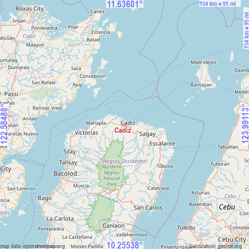
Cadiz GPS coordinates[2]
10° 56' 47.4" North, 123° 17' 16.8" East
| Map corner | latitude | longitude |
|---|---|---|
| Upper-left | 11.63601°, | 122.58488° |
| Center: | 10.9465°, | 123.288° |
| Lower-right: | 10.25538°, | 123.99113° |
| Map W x H: | 153.5×153.5 km | = 95.4×95.4mi |
| max Lat: | 20.78733° ⇑57.4% North |
| Cadiz: | 10.9465° |
| min Lat: | ⇓42.6% South 4.65442° |
| min Long | Cadiz | max Long |
| 117.04868° | 123.288° | 126.58417° |
| W 58.1%⇐ | ⇒41.9% E |
Elevation
Elevation of Cadiz is 12 m = 39 ft, and this is 75.9 m = 249 ft below average elevation for this country.
| Max E: |
2262 m = 7421 ft | 70.2% |
| Avg. | 87.9 m = 288 ft | |
| Cadiz | 12 m = 39 ft | |
Min E: |
-2 m = -7 ft | 29.8% |
See also: Cadiz elevation on elevation.city.
Geographical zone
Cadiz is located in North Torrid zone (between Equator and Tropic of Cancer). Distance of Equator is 1217.1 km =756.3 mi to South.| Distance of | km | miles | from Cadiz |
|---|---|---|---|
| North Pole | 8789.9 | 5461.8 | to North |
| Arctic Circle | 6184 | 3842.6 | to North |
| Tropic Cancer | 1388.8 | 863 | to North |
| Equator | 1217.1 | 756.3 | to South |


Nearby cities:
15 places around Cadiz: (largest is in red/bold)
• Andres Bonifacio
5.3 km =3.3 mi,  231°
231°
• Bato
17.9 km =11.1 mi,  148°
148°
• Bolanon
20.5 km =12.7 mi,  99°
99°
• Chambrey
13.5 km =8.4 mi,  284°
284°
• Lopez Jaena
17.6 km =10.9 mi,  128°
128°
• Luna
5.6 km =3.5 mi,  296°
296°
• Manapla
18.1 km =11.2 mi,  274°
274°
• Maquiling
21.7 km =13.5 mi, 147°
• Paraiso
10.7 km =6.6 mi, 130°
• Rizal
15.9 km =9.9 mi,  117°
117°
• Sagay
14.9 km =9.3 mi,  90°
90°
• San Pablo
16.4 km =10.2 mi,  256°
256°
• Tamlang
22.6 km =14 mi, 126°
• Tiglauigan
7.6 km =4.7 mi,  84°
84°
• Tortosa
21.7 km =13.5 mi, 266°
Sources, notices
• [Note1] Compared only with cities in Philippines existing in our database
• [Src1] Map data: © OpenStreetMap contributors (CC-BY-SA)
• [Src2] Other city data from geonames.org with taken over terms of usage.
• [Src3] Geographical zone / Annual Mean Temperature by Robert A. Rohde @ Wikipedia
