Carmen Grande geodata
Carmen Grande (Western Visayas) is a populated place; located in Philippines in Asia/Manila (GMT+8) time zone. With population of 4,945 people, there are 1315 cities with bigger population in this country. Compared to other cities in Philippines, 64.4% of cities are located further ↑North; 51.8% of cities are located further ←West and 60.8% of cities have higher elevation than Carmen Grande. Note1
Administrative division(s):
- Level 1: Western Visayas
- Level 2: Province of Negros Occidental
- Level 3: Pontevedra


Carmen Grande GPS coordinates[2]
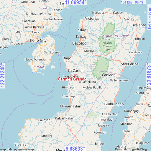
10° 22' 43.32" North, 122° 54' 56.16" East
| Map corner | latitude | longitude |
|---|---|---|
| Upper-left | 11.06954°, | 122.21248° |
| Center: | 10.3787°, | 122.9156° |
| Lower-right: | 9.68633°, | 123.61873° |
| Map W x H: | 153.8×153.8 km | = 95.6×95.6mi |
| max Lat: | 20.78733° ⇑64.4% North |
| Carmen Grande: | 10.3787° |
| min Lat: | ⇓35.6% South 4.65442° |
| min Long | Carmen Grande | max Long |
| 117.04868° | 122.9156° | 126.58417° |
| W 51.8%⇐ | ⇒48.2% E |
Elevation
Elevation of Carmen Grande is 16 m = 52 ft, and this is 71.9 m = 236 ft below average elevation for this country.
| Max E: |
2262 m = 7421 ft | 60.8% |
| Avg. | 87.9 m = 288 ft | |
| Carmen Grande | 16 m = 52 ft | |
Min E: |
-2 m = -7 ft | 39.2% |
See also: Philippines elevation on elevation.city.
Geographical zone
Carmen Grande is located in North Torrid zone (between Equator and Tropic of Cancer). Distance of Equator is 1154 km =717.1 mi to South.| Distance of | km | miles | from Carmen Grande |
|---|---|---|---|
| North Pole | 8853.1 | 5501.1 | to North |
| Arctic Circle | 6247.2 | 3881.8 | to North |
| Tropic Cancer | 1451.9 | 902.2 | to North |
| Equator | 1154 | 717.1 | to South |


Nearby cities:
15 places around Carmen Grande: (largest is in red/bold)
• Antipolo
5.9 km =3.7 mi,  114°
114°
• Bagumbayan
11.6 km =7.2 mi,  310°
310°
• Baliwagan
3.4 km =2.1 mi, 307°
• Canroma
4.5 km =2.8 mi,  243°
243°
• Haguimit
11.4 km =7.1 mi,  78°
78°
• Himaya
12.2 km =7.6 mi, 311°
• La Carlota
5.1 km =3.2 mi,  6°
6°
• La Granja
8.8 km =5.5 mi,  67°
67°
• Miranda
9.2 km =5.7 mi,  206°
206°
• Pontevedra
5.2 km =3.2 mi,  264°
264°
• Sagasa
10.2 km =6.3 mi,  346°
346°
• San Enrique
8.3 km =5.2 mi,  300°
300°
• San Juan
5.6 km =3.5 mi,  278°
278°
• San Miguel
12.3 km =7.6 mi, 70°
• Sibucao
5.4 km =3.4 mi,  324°
324°
Sources, notices
• [Note1] Compared only with cities in Philippines existing in our database
• [Src1] Map data: © OpenStreetMap contributors (CC-BY-SA)
• [Src2] Other city data from geonames.org with taken over terms of usage.
• [Src3] Geographical zone / Annual Mean Temperature by Robert A. Rohde @ Wikipedia
