Cabiao geodata
Cabiao (Central Luzon) is a seat of a third-order administrative division; located in Philippines in Asia/Manila (GMT+8) time zone. With population of 49,980 people, there are 176 cities with bigger population in this country. Compared to other cities in Philippines, 79.5% of cities are located further ↓South; 80.9% of cities are located further →East and 62.8% of cities have higher elevation than Cabiao. Note1


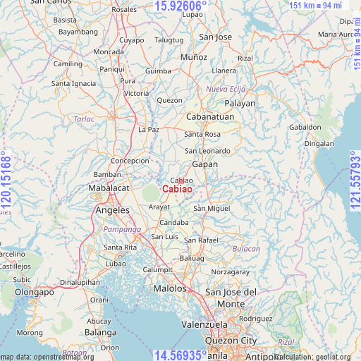
Cabiao GPS coordinates[2]
15° 14' 55.68" North, 120° 51' 17.28" East
| Map corner | latitude | longitude |
|---|---|---|
| Upper-left | 15.92606°, | 120.15168° |
| Center: | 15.2488°, | 120.8548° |
| Lower-right: | 14.56935°, | 121.55793° |
| Map W x H: | 150.9×150.9 km | = 93.8×93.8mi |
| max Lat: | 20.78733° ⇑20.5% North |
| Cabiao: | 15.2488° |
| min Lat: | ⇓79.5% South 4.65442° |
| min Long | Cabiao | max Long |
| 117.04868° | 120.8548° | 126.58417° |
| W 19.1%⇐ | ⇒80.9% E |
Elevation
Elevation of Cabiao is 15 m = 49 ft, and this is 72.9 m = 239 ft below average elevation for this country.
| Max E: |
2262 m = 7421 ft | 62.8% |
| Avg. | 87.9 m = 288 ft | |
| Cabiao | 15 m = 49 ft | |
Min E: |
-2 m = -7 ft | 37.2% |
See also: Cabiao elevation on elevation.city.
Geographical zone
Cabiao is located in North Torrid zone (between Equator and Tropic of Cancer). Distance of this Northern Tropic circle is 910.4 km =565.7 mi to North.| Distance of | km | miles | from Cabiao |
|---|---|---|---|
| North Pole | 8311.6 | 5164.6 | to North |
| Arctic Circle | 5705.7 | 3545.4 | to North |
| Tropic Cancer | 910.4 | 565.7 | to North |
| Equator | 1695.5 | 1053.5 | to South |


Nearby cities:
15 places around Cabiao: (largest is in red/bold)
• Alua
8.2 km =5.1 mi,  31°
31°
• Buliran Segundo
2.4 km =1.5 mi, 32°
• Calaba
6.1 km =3.8 mi,  19°
19°
• Concepcion
4 km =2.5 mi,  219°
219°
• Entablado
4.3 km =2.7 mi,  11°
11°
• Mandili
8.1 km =5 mi,  162°
162°
• Mangga
5.8 km =3.6 mi,  88°
88°
• Papaya
8.2 km =5.1 mi,  345°
345°
• Pulo
7.9 km =4.9 mi, 92°
• San Antonio
6.4 km =4 mi,  1°
1°
• San Vicente
5.5 km =3.4 mi, 224°
• Santa Cruz
6.6 km =4.1 mi,  358°
358°
• Santo Cristo
6.6 km =4.1 mi,  35°
35°
• Tabon
6.7 km =4.2 mi,  68°
68°
• Tikiw
7.1 km =4.4 mi, 5°
Sources, notices
• [Note1] Compared only with cities in Philippines existing in our database
• [Src1] Map data: © OpenStreetMap contributors (CC-BY-SA)
• [Src2] Other city data from geonames.org with taken over terms of usage.
• [Src3] Geographical zone / Annual Mean Temperature by Robert A. Rohde @ Wikipedia
