Pulo geodata
Pulo (Central Luzon) is a populated place; located in Philippines in Asia/Manila (GMT+8) time zone. With population of 10,776 people, there are 575 cities with bigger population in this country. Compared to other cities in Philippines, 79.5% of cities are located further ↓South; 78.5% of cities are located further →East and 59.2% of cities have higher elevation than Pulo. Note1
Administrative division(s):
- Level 1: Central Luzon
- Level 2: Province of Nueva Ecija
- Level 3: San Isidro


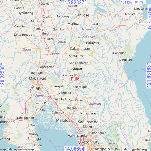
Pulo GPS coordinates[2]
15° 14' 45.6" North, 120° 55' 42.6" East
| Map corner | latitude | longitude |
|---|---|---|
| Upper-left | 15.92327°, | 120.22538° |
| Center: | 15.246°, | 120.9285° |
| Lower-right: | 14.56654°, | 121.63163° |
| Map W x H: | 150.9×150.9 km | = 93.8×93.8mi |
| max Lat: | 20.78733° ⇑20.5% North |
| Pulo: | 15.246° |
| min Lat: | ⇓79.5% South 4.65442° |
| min Long | Pulo | max Long |
| 117.04868° | 120.9285° | 126.58417° |
| W 21.5%⇐ | ⇒78.5% E |
Elevation
Elevation of Pulo is 17 m = 56 ft, and this is 70.9 m = 233 ft below average elevation for this country.
| Max E: |
2262 m = 7421 ft | 59.2% |
| Avg. | 87.9 m = 288 ft | |
| Pulo | 17 m = 56 ft | |
Min E: |
-2 m = -7 ft | 40.8% |
See also: Philippines elevation on elevation.city.
Geographical zone
Pulo is located in North Torrid zone (between Equator and Tropic of Cancer). Distance of this Northern Tropic circle is 910.7 km =565.9 mi to North.| Distance of | km | miles | from Pulo |
|---|---|---|---|
| North Pole | 8311.9 | 5164.8 | to North |
| Arctic Circle | 5706 | 3545.5 | to North |
| Tropic Cancer | 910.7 | 565.9 | to North |
| Equator | 1695.2 | 1053.3 | to South |


Nearby cities:
15 places around Pulo: (largest is in red/bold)
• Alua
8.2 km =5.1 mi,  333°
333°
• Buliran Segundo
7 km =4.3 mi,  289°
289°
• Bulualto
3.8 km =2.4 mi,  135°
135°
• Cabiao
7.9 km =4.9 mi,  272°
272°
• Calaba
8.4 km =5.2 mi,  316°
316°
• Entablado
8.3 km =5.2 mi,  302°
302°
• Gapan
7.1 km =4.4 mi,  15°
15°
• Jaen
9.1 km =5.7 mi,  353°
353°
• Mandili
9.2 km =5.7 mi,  216°
216°
• Mangga
2.2 km =1.4 mi,  283°
283°
• Nieves
9.4 km =5.8 mi,  13°
13°
• Pinambaran
7.2 km =4.5 mi,  132°
132°
• Santa Lucia
9.3 km =5.8 mi,  115°
115°
• Santo Cristo
7 km =4.3 mi, 324°
• Tabon
3.3 km =2.1 mi, 328°
Sources, notices
• [Note1] Compared only with cities in Philippines existing in our database
• [Src1] Map data: © OpenStreetMap contributors (CC-BY-SA)
• [Src2] Other city data from geonames.org with taken over terms of usage.
• [Src3] Geographical zone / Annual Mean Temperature by Robert A. Rohde @ Wikipedia
