Buguey geodata
Buguey (Cagayan Valley) is a seat of a second-order administrative division; located in Philippines in Asia/Manila (GMT+8) time zone. With population of 3,111 people, there are 2409 cities with bigger population in this country. Compared to other cities in Philippines, 99.2% of cities are located further ↓South; 62.3% of cities are located further →East and 76.6% of cities have higher elevation than Buguey. Note1


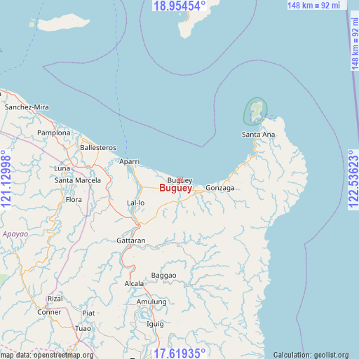
Buguey GPS coordinates[2]
18° 17' 17.628" North, 121° 49' 59.16" East
| Map corner | latitude | longitude |
|---|---|---|
| Upper-left | 18.95454°, | 121.12998° |
| Center: | 18.28823°, | 121.8331° |
| Lower-right: | 17.61935°, | 122.53623° |
| Map W x H: | 148.5×148.5 km | = 92.3×92.3mi |
| max Lat: | 20.78733° ⇑0.8% North |
| Buguey: | 18.28823° |
| min Lat: | ⇓99.2% South 4.65442° |
| min Long | Buguey | max Long |
| 117.04868° | 121.8331° | 126.58417° |
| W 37.7%⇐ | ⇒62.3% E |
Elevation
Elevation of Buguey is 10 m = 33 ft, and this is 77.9 m = 256 ft below average elevation for this country.
| Max E: |
2262 m = 7421 ft | 76.6% |
| Avg. | 87.9 m = 288 ft | |
| Buguey | 10 m = 33 ft | |
Min E: |
-2 m = -7 ft | 23.4% |
See also: Philippines elevation on elevation.city.
Geographical zone
Buguey is located in North Torrid zone (between Equator and Tropic of Cancer). Distance of this Northern Tropic circle is 572.5 km =355.7 mi to North.| Distance of | km | miles | from Buguey |
|---|---|---|---|
| North Pole | 7973.6 | 4954.6 | to North |
| Arctic Circle | 5367.7 | 3335.3 | to North |
| Tropic Cancer | 572.5 | 355.7 | to North |
| Equator | 2033.5 | 1263.6 | to South |


Nearby cities:
15 places around Buguey: (largest is in red/bold)
• Aparri
21.7 km =13.5 mi,  290°
290°
• Bagumbayan
20.8 km =12.9 mi,  239°
239°
• Camalaniugan
16.8 km =10.4 mi,  264°
264°
• Capissayan Sur
26.4 km =16.4 mi,  183°
183°
• Catayauan
23.7 km =14.7 mi,  233°
233°
• Gonzaga
17.4 km =10.8 mi,  100°
100°
• Magapit
24.1 km =15 mi, 225°
• Magapit, Aguiguican
26 km =16.2 mi,  219°
219°
• Maxingal
19.2 km =11.9 mi, 244°
• Paddaya
7.4 km =4.6 mi, 291°
• Paddaya
10.7 km =6.6 mi, 291°
• Pattao
5 km =3.1 mi,  202°
202°
• Santa Maria
24.1 km =15 mi, 227°
• Santa Teresita
9.6 km =6 mi,  118°
118°
• Tapel
20.7 km =12.9 mi,  89°
89°
Sources, notices
• [Note1] Compared only with cities in Philippines existing in our database
• [Src1] Map data: © OpenStreetMap contributors (CC-BY-SA)
• [Src2] Other city data from geonames.org with taken over terms of usage.
• [Src3] Geographical zone / Annual Mean Temperature by Robert A. Rohde @ Wikipedia
