Bitanjuan geodata
Bitanjuan (Eastern Visayas) is a populated place; located in Philippines in Asia/Manila (GMT+8) time zone. With population of 2,841 people, there are 2719 cities with bigger population in this country. Compared to other cities in Philippines, 62.1% of cities are located further ↑North; 83.4% of cities are located further ←West and 89.7% of cities have higher elevation than Bitanjuan. Note1
Administrative division(s):
- Level 1: Eastern Visayas
- Level 2: Province of Leyte
- Level 3: City of Baybay


Bitanjuan GPS coordinates[2]
10° 35' 43.8" North, 124° 45' 58.68" East
| Map corner | latitude | longitude |
|---|---|---|
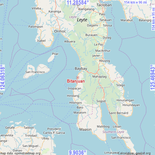
| Upper-left | 11.28584°, | 124.06318° |
| Center: | 10.5955°, | 124.7663° |
| Lower-right: | 9.9036°, | 125.46943° |
| Map W x H: | 153.7×153.7 km | = 95.5×95.5mi |
| max Lat: | 20.78733° ⇑62.1% North |
| Bitanjuan: | 10.5955° |
| min Lat: | ⇓37.9% South 4.65442° |
| min Long | Bitanjuan | max Long |
| 117.04868° | 124.7663° | 126.58417° |
| W 83.4%⇐ | ⇒16.6% E |
Elevation
Elevation of Bitanjuan is 7 m = 23 ft, and this is 80.9 m = 265 ft below average elevation for this country.
| Max E: |
2262 m = 7421 ft | 89.7% |
| Avg. | 87.9 m = 288 ft | |
| Bitanjuan | 7 m = 23 ft | |
Min E: |
-2 m = -7 ft | 10.3% |
See also: Philippines elevation on elevation.city.
Geographical zone
Bitanjuan is located in North Torrid zone (between Equator and Tropic of Cancer). Distance of Equator is 1178.1 km =732 mi to South.| Distance of | km | miles | from Bitanjuan |
|---|---|---|---|
| North Pole | 8829 | 5486.1 | to North |
| Arctic Circle | 6223.1 | 3866.9 | to North |
| Tropic Cancer | 1427.8 | 887.2 | to North |
| Equator | 1178.1 | 732 | to South |


Nearby cities:
15 places around Bitanjuan: (largest is in red/bold)
• Balinsacayao
23.2 km =14.4 mi,  65°
65°
• Baybay
10 km =6.2 mi,  22°
22°
• Bunga
19.8 km =12.3 mi,  5°
5°
• Concepcion
21.2 km =13.2 mi,  175°
175°
• Doos
15 km =9.3 mi,  195°
195°
• Gabas
15.3 km =9.5 mi, 12°
• Hilongos
24.6 km =15.3 mi, 184°
• Hindang
18.4 km =11.4 mi,  192°
192°
• Hipasngo
8.8 km =5.5 mi,  31°
31°
• Kilim
13.4 km =8.3 mi, 14°
• Lamak
22 km =13.7 mi, 187°
• Mahaplag
21.7 km =13.5 mi,  87°
87°
• Palhi
7.4 km =4.6 mi,  35°
35°
• Plaridel
3.2 km =2 mi, 183°
• Polahongon
23.4 km =14.5 mi,  108°
108°
Sources, notices
• [Note1] Compared only with cities in Philippines existing in our database
• [Src1] Map data: © OpenStreetMap contributors (CC-BY-SA)
• [Src2] Other city data from geonames.org with taken over terms of usage.
• [Src3] Geographical zone / Annual Mean Temperature by Robert A. Rohde @ Wikipedia
