Barayong geodata
Barayong (Bicol) is a populated place; located in Philippines in Asia/Manila (GMT+8) time zone. With population of 2,433 people, there are 3407 cities with bigger population in this country. Compared to other cities in Philippines, 58.1% of cities are located further ↓South; 66% of cities are located further ←West and 78.9% of cities have lower elevation than Barayong. Note1


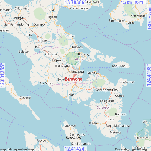
Barayong GPS coordinates[2]
13° 6' 0" North, 123° 43' 0.012" East
| Map corner | latitude | longitude |
|---|---|---|
| Upper-left | 13.78386°, | 123.01355° |
| Center: | 13.1°, | 123.71667° |
| Lower-right: | 12.41424°, | 124.4198° |
| Map W x H: | 152.3×152.3 km | = 94.6×94.6mi |
| max Lat: | 20.78733° ⇑41.9% North |
| Barayong: | 13.1° |
| min Lat: | ⇓58.1% South 4.65442° |
| min Long | Barayong | max Long |
| 117.04868° | 123.71667° | 126.58417° |
| W 66%⇐ | ⇒34% E |
Elevation
Elevation of Barayong is 85 m = 279 ft, and this is 2.9 m = 10 ft below average elevation for this country.
| Max E: |
2262 m = 7421 ft | 21.1% |
| Avg. | 87.9 m = 288 ft | |
| Barayong | 85 m = 279 ft | |
Min E: |
-2 m = -7 ft | 78.9% |
See also: Philippines elevation on elevation.city.
Geographical zone
Barayong is located in North Torrid zone (between Equator and Tropic of Cancer). Distance of this Northern Tropic circle is 1149.3 km =714.1 mi to North.| Distance of | km | miles | from Barayong |
|---|---|---|---|
| North Pole | 8550.5 | 5313 | to North |
| Arctic Circle | 5944.6 | 3693.8 | to North |
| Tropic Cancer | 1149.3 | 714.1 | to North |
| Equator | 1456.6 | 905.1 | to South |


Nearby cities:
15 places around Barayong: (largest is in red/bold)
• Aanislag
3.2 km =2 mi,  207°
207°
• Bangkirohan
5.9 km =3.7 mi,  146°
146°
• Bariw
4.1 km =2.5 mi,  25°
25°
• Bascaron
1.8 km =1.1 mi,  280°
280°
• Cotmon
6.1 km =3.8 mi,  288°
288°
• Daraga
5.4 km =3.4 mi,  355°
355°
• Lacag
7.2 km =4.5 mi,  328°
328°
• Legaspi
5.3 km =3.3 mi, 29°
• Malabog
8.8 km =5.5 mi,  338°
338°
• Maslog
5.9 km =3.7 mi,  85°
85°
• Pawa
8.7 km =5.4 mi,  9°
9°
• Sagpon
5.8 km =3.6 mi,  17°
17°
• San Roque
7.3 km =4.5 mi, 33°
• Tagas
7.4 km =4.6 mi,  0°
0°
• Villahermosa
6 km =3.7 mi,  183°
183°
Sources, notices
• [Note1] Compared only with cities in Philippines existing in our database
• [Src1] Map data: © OpenStreetMap contributors (CC-BY-SA)
• [Src2] Other city data from geonames.org with taken over terms of usage.
• [Src3] Geographical zone / Annual Mean Temperature by Robert A. Rohde @ Wikipedia
