Villahermosa geodata
Villahermosa (Bicol) is a populated place; located in Philippines in Asia/Manila (GMT+8) time zone. With population of 2,428 people, there are 3415 cities with bigger population in this country. Compared to other cities in Philippines, 57.7% of cities are located further ↓South; 65.9% of cities are located further ←West and 64.1% of cities have lower elevation than Villahermosa. Note1


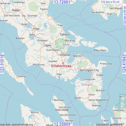
Villahermosa GPS coordinates[2]
13° 2' 44.88" North, 123° 42' 47.88" East
| Map corner | latitude | longitude |
|---|---|---|
| Upper-left | 13.72981°, | 123.01018° |
| Center: | 13.0458°, | 123.7133° |
| Lower-right: | 12.35989°, | 124.41643° |
| Map W x H: | 152.3×152.3 km | = 94.6×94.6mi |
| max Lat: | 20.78733° ⇑42.3% North |
| Villahermosa: | 13.0458° |
| min Lat: | ⇓57.7% South 4.65442° |
| min Long | Villahermosa | max Long |
| 117.04868° | 123.7133° | 126.58417° |
| W 65.9%⇐ | ⇒34.1% E |
Elevation
Elevation of Villahermosa is 40 m = 131 ft, and this is 47.9 m = 157 ft below average elevation for this country.
| Max E: |
2262 m = 7421 ft | 35.9% |
| Avg. | 87.9 m = 288 ft | |
| Villahermosa | 40 m = 131 ft | |
Min E: |
-2 m = -7 ft | 64.1% |
See also: Philippines elevation on elevation.city.
Geographical zone
Villahermosa is located in North Torrid zone (between Equator and Tropic of Cancer). Distance of this Northern Tropic circle is 1155.4 km =717.9 mi to North.| Distance of | km | miles | from Villahermosa |
|---|---|---|---|
| North Pole | 8556.5 | 5316.8 | to North |
| Arctic Circle | 5950.6 | 3697.5 | to North |
| Tropic Cancer | 1155.4 | 717.9 | to North |
| Equator | 1450.6 | 901.4 | to South |


Nearby cities:
15 places around Villahermosa: (largest is in red/bold)
• Aanislag
3.4 km =2.1 mi,  340°
340°
• Abucay
9.9 km =6.2 mi,  224°
224°
• Bangkirohan
3.8 km =2.4 mi,  73°
73°
• Barayong
6 km =3.7 mi,  3°
3°
• Bariw
10 km =6.2 mi,  12°
12°
• Bascaron
6.5 km =4 mi,  347°
347°
• Cotmon
9.6 km =6 mi,  326°
326°
• Cumadcad
11 km =6.8 mi,  131°
131°
• Daraga
11.4 km =7.1 mi,  359°
359°
• Legaspi
11 km =6.8 mi,  15°
15°
• Maslog
9.1 km =5.7 mi,  43°
43°
• Putiao
2.9 km =1.8 mi,  176°
176°
• Sagpon
11.8 km =7.3 mi, 10°
• Salvacion
10.7 km =6.6 mi,  282°
282°
• San Francisco
7.6 km =4.7 mi,  97°
97°
Sources, notices
• [Note1] Compared only with cities in Philippines existing in our database
• [Src1] Map data: © OpenStreetMap contributors (CC-BY-SA)
• [Src2] Other city data from geonames.org with taken over terms of usage.
• [Src3] Geographical zone / Annual Mean Temperature by Robert A. Rohde @ Wikipedia
