Aanislag geodata
Aanislag (Bicol) is a populated place; located in Philippines in Asia/Manila (GMT+8) time zone. With population of 4,061 people, there are 1690 cities with bigger population in this country. Compared to other cities in Philippines, 58% of cities are located further ↓South; 65.7% of cities are located further ←West and 77.4% of cities have lower elevation than Aanislag. Note1


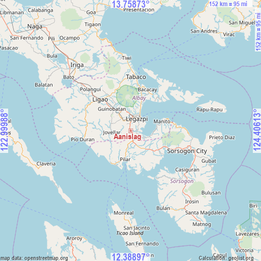
Aanislag GPS coordinates[2]
13° 4' 29.28" North, 123° 42' 10.8" East
| Map corner | latitude | longitude |
|---|---|---|
| Upper-left | 13.75873°, | 122.99988° |
| Center: | 13.0748°, | 123.703° |
| Lower-right: | 12.38897°, | 124.40613° |
| Map W x H: | 152.3×152.3 km | = 94.6×94.6mi |
| max Lat: | 20.78733° ⇑42% North |
| Aanislag: | 13.0748° |
| min Lat: | ⇓58% South 4.65442° |
| min Long | Aanislag | max Long |
| 117.04868° | 123.703° | 126.58417° |
| W 65.7%⇐ | ⇒34.3% E |
Elevation
Elevation of Aanislag is 77 m = 253 ft, and this is 10.9 m = 36 ft below average elevation for this country.
| Max E: |
2262 m = 7421 ft | 22.6% |
| Avg. | 87.9 m = 288 ft | |
| Aanislag | 77 m = 253 ft | |
Min E: |
-2 m = -7 ft | 77.4% |
See also: Philippines elevation on elevation.city.
Geographical zone
Aanislag is located in North Torrid zone (between Equator and Tropic of Cancer). Distance of this Northern Tropic circle is 1152.1 km =715.9 mi to North.| Distance of | km | miles | from Aanislag |
|---|---|---|---|
| North Pole | 8553.3 | 5314.8 | to North |
| Arctic Circle | 5947.4 | 3695.5 | to North |
| Tropic Cancer | 1152.1 | 715.9 | to North |
| Equator | 1453.8 | 903.3 | to South |


Nearby cities:
15 places around Aanislag: (largest is in red/bold)
• Bangkirohan
5.2 km =3.2 mi,  114°
114°
• Barayong
3.2 km =2 mi,  27°
27°
• Bariw
7.3 km =4.5 mi, 26°
• Bascaron
3.1 km =1.9 mi,  353°
353°
• Cotmon
6.4 km =4 mi,  318°
318°
• Daraga
8.2 km =5.1 mi,  7°
7°
• Lacag
9.3 km =5.8 mi, 345°
• Legaspi
8.4 km =5.2 mi, 28°
• Maslog
8.1 km =5 mi,  65°
65°
• Putiao
6.3 km =3.9 mi,  168°
168°
• Sagpon
9 km =5.6 mi,  21°
21°
• Salvacion
9.4 km =5.8 mi,  264°
264°
• San Francisco
9.7 km =6 mi,  115°
115°
• Tagas
10.3 km =6.4 mi, 8°
• Villahermosa
3.4 km =2.1 mi,  160°
160°
Sources, notices
• [Note1] Compared only with cities in Philippines existing in our database
• [Src1] Map data: © OpenStreetMap contributors (CC-BY-SA)
• [Src2] Other city data from geonames.org with taken over terms of usage.
• [Src3] Geographical zone / Annual Mean Temperature by Robert A. Rohde @ Wikipedia
