Balibago geodata
Balibago (Calabarzon) is a populated place; located in Philippines in Asia/Manila (GMT+8) time zone. With population of 3,121 people, there are 2395 cities with bigger population in this country. Compared to other cities in Philippines, 63.4% of cities are located further ↓South; 70.2% of cities are located further →East and 73.1% of cities have lower elevation than Balibago. Note1


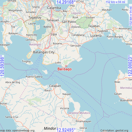
Balibago GPS coordinates[2]
13° 36' 33.48" North, 121° 17' 49.56" East
| Map corner | latitude | longitude |
|---|---|---|
| Upper-left | 14.29168°, | 120.59398° |
| Center: | 13.6093°, | 121.2971° |
| Lower-right: | 12.92495°, | 122.00023° |
| Map W x H: | 152×152 km | = 94.4×94.4mi |
| max Lat: | 20.78733° ⇑36.6% North |
| Balibago: | 13.6093° |
| min Lat: | ⇓63.4% South 4.65442° |
| min Long | Balibago | max Long |
| 117.04868° | 121.2971° | 126.58417° |
| W 29.8%⇐ | ⇒70.2% E |
Elevation
Elevation of Balibago is 61 m = 200 ft, and this is 26.9 m = 88 ft below average elevation for this country.
| Max E: |
2262 m = 7421 ft | 26.9% |
| Avg. | 87.9 m = 288 ft | |
| Balibago | 61 m = 200 ft | |
Min E: |
-2 m = -7 ft | 73.1% |
See also: Philippines elevation on elevation.city.
Geographical zone
Balibago is located in North Torrid zone (between Equator and Tropic of Cancer). Distance of this Northern Tropic circle is 1092.7 km =679 mi to North.| Distance of | km | miles | from Balibago |
|---|---|---|---|
| North Pole | 8493.8 | 5277.8 | to North |
| Arctic Circle | 5888 | 3658.6 | to North |
| Tropic Cancer | 1092.7 | 679 | to North |
| Equator | 1513.2 | 940.3 | to South |


Nearby cities:
15 places around Balibago: (largest is in red/bold)
• Banalo
13.1 km =8.1 mi,  288°
288°
• Bulihan
22.8 km =14.2 mi,  346°
346°
• Calubcub Dos
19.8 km =12.3 mi,  43°
43°
• Dagatan
17.9 km =11.1 mi,  323°
323°
• Haligue
20.5 km =12.7 mi, 288°
• Laiya
13.7 km =8.5 mi,  54°
54°
• Libato
23.2 km =14.4 mi,  10°
10°
• Lobo
10.2 km =6.3 mi, 294°
• Mapulo
18.3 km =11.4 mi, 318°
• Pulangbato
19.1 km =11.9 mi,  32°
32°
• Quipot
21.8 km =13.5 mi, 29°
• Sampiro
21.6 km =13.4 mi, 25°
• San Isidro
19.1 km =11.9 mi,  337°
337°
• Talahib Payap
18.3 km =11.4 mi, 288°
• Talahiban I
23.7 km =14.7 mi,  22°
22°
Sources, notices
• [Note1] Compared only with cities in Philippines existing in our database
• [Src1] Map data: © OpenStreetMap contributors (CC-BY-SA)
• [Src2] Other city data from geonames.org with taken over terms of usage.
• [Src3] Geographical zone / Annual Mean Temperature by Robert A. Rohde @ Wikipedia
