Ampatuan geodata
Ampatuan (Autonomous Region in Muslim Mindanao) is a seat of a third-order administrative division; located in Philippines in Asia/Manila (GMT+8) time zone. With population of 3,962 people, there are 1754 cities with bigger population in this country. Compared to other cities in Philippines, 92.8% of cities are located further ↑North; 78.4% of cities are located further ←West and 54.5% of cities have higher elevation than Ampatuan. Note1
Administrative division(s):
- Level 1: Autonomous Region in Muslim Mindanao
- Level 2: Province of Maguindanao
- Level 3: Shariff Aguak (Maganoy)


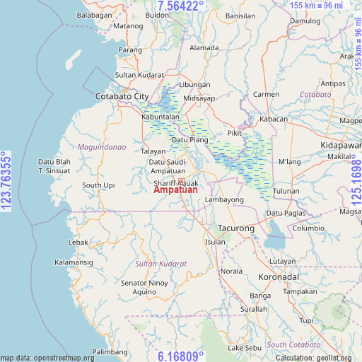
Ampatuan GPS coordinates[2]
6° 52' 0.012" North, 124° 28' 0.012" East
| Map corner | latitude | longitude |
|---|---|---|
| Upper-left | 7.56422°, | 123.76355° |
| Center: | 6.86667°, | 124.46667° |
| Lower-right: | 6.16809°, | 125.1698° |
| Map W x H: | 155.2×155.2 km | = 96.4×96.4mi |
| max Lat: | 20.78733° ⇑92.8% North |
| Ampatuan: | 6.86667° |
| min Lat: | ⇓7.2% South 4.65442° |
| min Long | Ampatuan | max Long |
| 117.04868° | 124.46667° | 126.58417° |
| W 78.4%⇐ | ⇒21.6% E |
Elevation
Elevation of Ampatuan is 20 m = 66 ft, and this is 67.9 m = 223 ft below average elevation for this country.
| Max E: |
2262 m = 7421 ft | 54.5% |
| Avg. | 87.9 m = 288 ft | |
| Ampatuan | 20 m = 66 ft | |
Min E: |
-2 m = -7 ft | 45.5% |
See also: Philippines elevation on elevation.city.
Geographical zone
Ampatuan is located in North Torrid zone (between Equator and Tropic of Cancer). Distance of Equator is 763.5 km =474.4 mi to South.| Distance of | km | miles | from Ampatuan |
|---|---|---|---|
| North Pole | 9243.6 | 5743.7 | to North |
| Arctic Circle | 6637.7 | 4124.5 | to North |
| Tropic Cancer | 1842.4 | 1144.8 | to North |
| Equator | 763.5 | 474.4 | to South |


Nearby cities:
15 places around Ampatuan: (largest is in red/bold)
• Bagan
8.3 km =5.2 mi,  321°
321°
• Barurao
14.9 km =9.3 mi,  76°
76°
• Dalican
13.3 km =8.3 mi,  326°
326°
• Kauran
8 km =5 mi,  177°
177°
• Kitango
9.5 km =5.9 mi,  342°
342°
• Kitapak
10.7 km =6.6 mi, 334°
• Maganoy
2.8 km =1.7 mi,  265°
265°
• Mileb
13.4 km =8.3 mi,  74°
74°
• Pagatin
11.9 km =7.4 mi,  4°
4°
• Pidsandawan
15.5 km =9.6 mi,  61°
61°
• Sagasa
15.7 km =9.8 mi,  130°
130°
• Sampao
14.3 km =8.9 mi,  85°
85°
• Satan
6.4 km =4 mi, 266°
• Talayan
15.7 km =9.8 mi, 323°
• Tapikan
16 km =9.9 mi,  264°
264°
Sources, notices
• [Note1] Compared only with cities in Philippines existing in our database
• [Src1] Map data: © OpenStreetMap contributors (CC-BY-SA)
• [Src2] Other city data from geonames.org with taken over terms of usage.
• [Src3] Geographical zone / Annual Mean Temperature by Robert A. Rohde @ Wikipedia
