Aguining geodata
Aguining (Central Visayas) is a populated place; located in Philippines in Asia/Manila (GMT+8) time zone. With population of 2,488 people, there are 3311 cities with bigger population in this country. Compared to other cities in Philippines, 67.5% of cities are located further ↑North; 80.7% of cities are located further ←West and 89.7% of cities have higher elevation than Aguining. Note1
Administrative division(s):
- Level 1: Central Visayas
- Level 2: Bohol
- Level 3: Pres. Carlos P. Garcia (Pitogo)


Aguining GPS coordinates[2]
10° 5' 9.96" North, 124° 35' 39.84" East
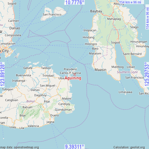
| Map corner | latitude | longitude |
|---|---|---|
| Upper-left | 10.7776°, | 123.89128° |
| Center: | 10.0861°, | 124.5944° |
| Lower-right: | 9.39311°, | 125.29753° |
| Map W x H: | 153.9×153.9 km | = 95.6×95.6mi |
| max Lat: | 20.78733° ⇑67.5% North |
| Aguining: | 10.0861° |
| min Lat: | ⇓32.5% South 4.65442° |
| min Long | Aguining | max Long |
| 117.04868° | 124.5944° | 126.58417° |
| W 80.7%⇐ | ⇒19.3% E |
Elevation
Elevation of Aguining is 7 m = 23 ft, and this is 80.9 m = 265 ft below average elevation for this country.
| Max E: |
2262 m = 7421 ft | 89.7% |
| Avg. | 87.9 m = 288 ft | |
| Aguining | 7 m = 23 ft | |
Min E: |
-2 m = -7 ft | 10.3% |
See also: Philippines elevation on elevation.city.
Geographical zone
Aguining is located in North Torrid zone (between Equator and Tropic of Cancer). Distance of Equator is 1121.5 km =696.9 mi to South.| Distance of | km | miles | from Aguining |
|---|---|---|---|
| North Pole | 8885.6 | 5521.3 | to North |
| Arctic Circle | 6279.7 | 3902 | to North |
| Tropic Cancer | 1484.4 | 922.4 | to North |
| Equator | 1121.5 | 696.9 | to South |


Nearby cities:
15 places around Aguining: (largest is in red/bold)
• Abaca
20.9 km =13 mi,  207°
207°
• Alicia
27 km =16.8 mi,  218°
218°
• Bien Unido
24.4 km =15.2 mi,  283°
283°
• Camambugan
17.4 km =10.8 mi,  259°
259°
• Cogtong
28.6 km =17.8 mi,  194°
194°
• Maasin
27.9 km =17.3 mi,  79°
79°
• Mabini
25.9 km =16.1 mi,  197°
197°
• Pitogo
6 km =3.7 mi,  311°
311°
• San Pascual
23.4 km =14.5 mi,  230°
230°
• Santa Fe
25.7 km =16 mi,  49°
49°
• Tagum Norte
22.5 km =14 mi,  266°
266°
• Tipolo
11.5 km =7.1 mi, 229°
• Trinidad
27.5 km =17.1 mi, 268°
• Ubay
13.7 km =8.5 mi, 255°
• Union
9.7 km =6 mi,  243°
243°
Sources, notices
• [Note1] Compared only with cities in Philippines existing in our database
• [Src1] Map data: © OpenStreetMap contributors (CC-BY-SA)
• [Src2] Other city data from geonames.org with taken over terms of usage.
• [Src3] Geographical zone / Annual Mean Temperature by Robert A. Rohde @ Wikipedia
