Camambugan geodata
Camambugan (Central Visayas) is a populated place; located in Philippines in Asia/Manila (GMT+8) time zone. With population of 2,265 people, there are 3756 cities with bigger population in this country. Compared to other cities in Philippines, 67.8% of cities are located further ↑North; 78% of cities are located further ←West and 73.2% of cities have higher elevation than Camambugan. Note1


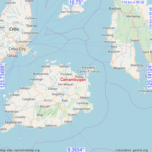
Camambugan GPS coordinates[2]
10° 3' 30.384" North, 124° 26' 17.196" East
| Map corner | latitude | longitude |
|---|---|---|
| Upper-left | 10.75°, | 123.73499° |
| Center: | 10.05844°, | 124.43811° |
| Lower-right: | 9.3654°, | 125.14124° |
| Map W x H: | 154×154 km | = 95.7×95.7mi |
| max Lat: | 20.78733° ⇑67.8% North |
| Camambugan: | 10.05844° |
| min Lat: | ⇓32.2% South 4.65442° |
| min Long | Camambugan | max Long |
| 117.04868° | 124.43811° | 126.58417° |
| W 78%⇐ | ⇒22% E |
Elevation
Elevation of Camambugan is 11 m = 36 ft, and this is 76.9 m = 252 ft below average elevation for this country.
| Max E: |
2262 m = 7421 ft | 73.2% |
| Avg. | 87.9 m = 288 ft | |
| Camambugan | 11 m = 36 ft | |
Min E: |
-2 m = -7 ft | 26.8% |
See also: Philippines elevation on elevation.city.
Geographical zone
Camambugan is located in North Torrid zone (between Equator and Tropic of Cancer). Distance of Equator is 1118.4 km =694.9 mi to South.| Distance of | km | miles | from Camambugan |
|---|---|---|---|
| North Pole | 8888.7 | 5523.2 | to North |
| Arctic Circle | 6282.8 | 3903.9 | to North |
| Tropic Cancer | 1487.5 | 924.3 | to North |
| Equator | 1118.4 | 694.9 | to South |


Nearby cities:
15 places around Camambugan: (largest is in red/bold)
• Abaca
17 km =10.6 mi,  154°
154°
• Aguining
17.4 km =10.8 mi,  79°
79°
• Bien Unido
11 km =6.8 mi,  322°
322°
• Hinlayagan Ilaud
11.8 km =7.3 mi,  254°
254°
• Pitogo
14.4 km =8.9 mi,  60°
60°
• San Francisco
17.9 km =11.1 mi,  309°
309°
• San Miguel
13.3 km =8.3 mi,  233°
233°
• San Pascual
11.7 km =7.3 mi,  185°
185°
• San Roque
13.2 km =8.2 mi,  286°
286°
• Tagum Norte
5.6 km =3.5 mi, 288°
• Talibon
16 km =9.9 mi, 309°
• Tipolo
9.4 km =5.8 mi,  117°
117°
• Trinidad
10.6 km =6.6 mi,  282°
282°
• Ubay
3.8 km =2.4 mi,  94°
94°
• Union
8.5 km =5.3 mi,  98°
98°
Sources, notices
• [Note1] Compared only with cities in Philippines existing in our database
• [Src1] Map data: © OpenStreetMap contributors (CC-BY-SA)
• [Src2] Other city data from geonames.org with taken over terms of usage.
• [Src3] Geographical zone / Annual Mean Temperature by Robert A. Rohde @ Wikipedia
