Bualan geodata
Bualan (Autonomous Region in Muslim Mindanao) is a populated place; located in Philippines in Asia/Manila (GMT+8) time zone. With population of 3,007 people, there are 2521 cities with bigger population in this country. Compared to other cities in Philippines, 87.4% of cities are located further ↑North; 74.9% of cities are located further ←West and 86.4% of cities have lower elevation than Bualan. Note1
Administrative division(s):
- Level 1: Autonomous Region in Muslim Mindanao
- Level 2: Province of Maguindanao
- Level 3: Matanog


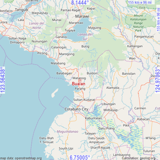
Bualan GPS coordinates[2]
7° 26' 52.008" North, 124° 16' 3" East
| Map corner | latitude | longitude |
|---|---|---|
| Upper-left | 8.1444°, | 123.56438° |
| Center: | 7.44778°, | 124.2675° |
| Lower-right: | 6.75005°, | 124.97063° |
| Map W x H: | 155×155 km | = 96.3×96.3mi |
| max Lat: | 20.78733° ⇑87.4% North |
| Bualan: | 7.44778° |
| min Lat: | ⇓12.6% South 4.65442° |
| min Long | Bualan | max Long |
| 117.04868° | 124.2675° | 126.58417° |
| W 74.9%⇐ | ⇒25.1% E |
Elevation
Elevation of Bualan is 157 m = 515 ft, and this is 69.1 m = 227 ft above average elevation for this country.
| Max E: |
2262 m = 7421 ft | 13.6% |
| Bualan | 157 m 515 ft | |
| Avg. | 87.9 m = 288 ft | |
Min E: |
-2 m = -7 ft | 86.4% |
See also: Philippines elevation on elevation.city.
Geographical zone
Bualan is located in North Torrid zone (between Equator and Tropic of Cancer). Distance of Equator is 828.1 km =514.6 mi to South.| Distance of | km | miles | from Bualan |
|---|---|---|---|
| North Pole | 9178.9 | 5703.5 | to North |
| Arctic Circle | 6573.1 | 4084.3 | to North |
| Tropic Cancer | 1777.8 | 1104.7 | to North |
| Equator | 828.1 | 514.6 | to South |


Nearby cities:
15 places around Bualan: (largest is in red/bold)
• Barira
5.6 km =3.5 mi,  38°
38°
• Bayanga
8.4 km =5.2 mi,  348°
348°
• Bugasan
1.2 km =0.7 mi,  229°
229°
• Buldon
13.4 km =8.3 mi,  58°
58°
• Ebcor Town
14.3 km =8.9 mi,  93°
93°
• Katuli
5.8 km =3.6 mi,  254°
254°
• Kulempang
15.7 km =9.8 mi, 59°
• Matanog
7.7 km =4.8 mi, 350°
• Mataya
11.8 km =7.3 mi,  77°
77°
• Nuyo
16.1 km =10 mi,  101°
101°
• Parang
8.6 km =5.3 mi,  178°
178°
• Polloc
11.7 km =7.3 mi,  206°
206°
• Rominimbang
6.8 km =4.2 mi,  31°
31°
• Sapadun
4.4 km =2.7 mi,  333°
333°
• Tapayan
17.1 km =10.6 mi, 180°
Sources, notices
• [Note1] Compared only with cities in Philippines existing in our database
• [Src1] Map data: © OpenStreetMap contributors (CC-BY-SA)
• [Src2] Other city data from geonames.org with taken over terms of usage.
• [Src3] Geographical zone / Annual Mean Temperature by Robert A. Rohde @ Wikipedia
