Kulempang geodata
Kulempang (Autonomous Region in Muslim Mindanao) is a populated place; located in Philippines in Asia/Manila (GMT+8) time zone. With population of 2,384 people, there are 3490 cities with bigger population in this country. Compared to other cities in Philippines, 86.8% of cities are located further ↑North; 77.2% of cities are located further ←West and 95.3% of cities have lower elevation than Kulempang. Note1
Administrative division(s):
- Level 1: Autonomous Region in Muslim Mindanao
- Level 2: Province of Maguindanao
- Level 3: Buldon


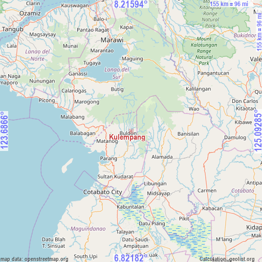
Kulempang GPS coordinates[2]
7° 31' 9.984" North, 124° 23' 22.992" East
| Map corner | latitude | longitude |
|---|---|---|
| Upper-left | 8.21594°, | 123.6866° |
| Center: | 7.51944°, | 124.38972° |
| Lower-right: | 6.82182°, | 125.09285° |
| Map W x H: | 155×155 km | = 96.3×96.3mi |
| max Lat: | 20.78733° ⇑86.8% North |
| Kulempang: | 7.51944° |
| min Lat: | ⇓13.2% South 4.65442° |
| min Long | Kulempang | max Long |
| 117.04868° | 124.38972° | 126.58417° |
| W 77.2%⇐ | ⇒22.8% E |
Elevation
Elevation of Kulempang is 442 m = 1450 ft, and this is 354.1 m = 1162 ft above average elevation for this country.
| Max E: |
2262 m = 7421 ft | 4.7% |
| Kulempang | 442 m 1450 ft | |
| Avg. | 87.9 m = 288 ft | |
Min E: |
-2 m = -7 ft | 95.3% |
See also: Philippines elevation on elevation.city.
Geographical zone
Kulempang is located in North Torrid zone (between Equator and Tropic of Cancer). Distance of Equator is 836.1 km =519.5 mi to South.| Distance of | km | miles | from Kulempang |
|---|---|---|---|
| North Pole | 9171 | 5698.6 | to North |
| Arctic Circle | 6565.1 | 4079.4 | to North |
| Tropic Cancer | 1769.8 | 1099.7 | to North |
| Equator | 836.1 | 519.5 | to South |


Nearby cities:
15 places around Kulempang: (largest is in red/bold)
• Barira
10.6 km =6.6 mi,  250°
250°
• Bayanga
15.2 km =9.4 mi,  270°
270°
• Bualan
15.7 km =9.8 mi,  239°
239°
• Bugasan
16.8 km =10.4 mi, 238°
• Buldon
2.3 km =1.4 mi, 241°
• Butig
24.8 km =15.4 mi,  336°
336°
• Dinganen
21.3 km =13.2 mi,  183°
183°
• Ebcor Town
8.8 km =5.5 mi,  174°
174°
• Katuli
21.3 km =13.2 mi, 243°
• Matanog
14.7 km =9.1 mi, 268°
• Mataya
5.7 km =3.5 mi,  200°
200°
• Nuyo
11.5 km =7.1 mi, 168°
• Parang
21.2 km =13.2 mi,  218°
218°
• Rominimbang
10.1 km =6.3 mi,  257°
257°
• Sapadun
15.9 km =9.9 mi, 255°
Sources, notices
• [Note1] Compared only with cities in Philippines existing in our database
• [Src1] Map data: © OpenStreetMap contributors (CC-BY-SA)
• [Src2] Other city data from geonames.org with taken over terms of usage.
• [Src3] Geographical zone / Annual Mean Temperature by Robert A. Rohde @ Wikipedia
