Barira geodata
Barira (Autonomous Region in Muslim Mindanao) is a seat of a third-order administrative division; located in Philippines in Asia/Manila (GMT+8) time zone. With population of 3,717 people, there are 1908 cities with bigger population in this country. Compared to other cities in Philippines, 87.1% of cities are located further ↑North; 75.5% of cities are located further ←West and 96.4% of cities have lower elevation than Barira. Note1
Administrative division(s):
- Level 1: Autonomous Region in Muslim Mindanao
- Level 2: Province of Maguindanao
- Level 3: Barira


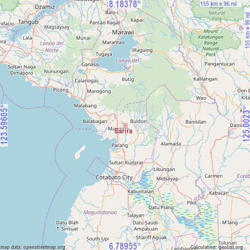
Barira GPS coordinates[2]
7° 29' 13.992" North, 124° 17' 57.012" East
| Map corner | latitude | longitude |
|---|---|---|
| Upper-left | 8.18378°, | 123.59605° |
| Center: | 7.48722°, | 124.29917° |
| Lower-right: | 6.78955°, | 125.0023° |
| Map W x H: | 155×155 km | = 96.3×96.3mi |
| max Lat: | 20.78733° ⇑87.1% North |
| Barira: | 7.48722° |
| min Lat: | ⇓12.9% South 4.65442° |
| min Long | Barira | max Long |
| 117.04868° | 124.29917° | 126.58417° |
| W 75.5%⇐ | ⇒24.5% E |
Elevation
Elevation of Barira is 534 m = 1752 ft, and this is 446.1 m = 1464 ft above average elevation for this country.
| Max E: |
2262 m = 7421 ft | 3.6% |
| Barira | 534 m 1752 ft | |
| Avg. | 87.9 m = 288 ft | |
Min E: |
-2 m = -7 ft | 96.4% |
See also: Philippines elevation on elevation.city.
Geographical zone
Barira is located in North Torrid zone (between Equator and Tropic of Cancer). Distance of Equator is 832.5 km =517.3 mi to South.| Distance of | km | miles | from Barira |
|---|---|---|---|
| North Pole | 9174.6 | 5700.8 | to North |
| Arctic Circle | 6568.7 | 4081.6 | to North |
| Tropic Cancer | 1773.4 | 1101.9 | to North |
| Equator | 832.5 | 517.3 | to South |


Nearby cities:
15 places around Barira: (largest is in red/bold)
• Bayanga
6.4 km =4 mi,  306°
306°
• Bualan
5.6 km =3.5 mi,  218°
218°
• Bugasan
6.8 km =4.2 mi, 220°
• Buldon
8.3 km =5.2 mi,  72°
72°
• Dinganen
19.7 km =12.2 mi,  153°
153°
• Ebcor Town
12 km =7.5 mi,  115°
115°
• Katuli
10.9 km =6.8 mi,  236°
236°
• Kulempang
10.6 km =6.6 mi, 70°
• Matanog
5.7 km =3.5 mi,  304°
304°
• Mataya
8.2 km =5.1 mi,  102°
102°
• Nuyo
14.5 km =9 mi, 121°
• Parang
13.4 km =8.3 mi,  194°
194°
• Polloc
17.2 km =10.7 mi,  210°
210°
• Rominimbang
1.4 km =0.9 mi,  3°
3°
• Sapadun
5.4 km =3.4 mi,  265°
265°
Sources, notices
• [Note1] Compared only with cities in Philippines existing in our database
• [Src1] Map data: © OpenStreetMap contributors (CC-BY-SA)
• [Src2] Other city data from geonames.org with taken over terms of usage.
• [Src3] Geographical zone / Annual Mean Temperature by Robert A. Rohde @ Wikipedia
