Parang geodata
Parang (Autonomous Region in Muslim Mindanao) is a seat of a third-order administrative division; located in Philippines in Asia/Manila (GMT+8) time zone. With population of 44,930 people, there are 192 cities with bigger population in this country. Compared to other cities in Philippines, 87.9% of cities are located further ↑North; 74.9% of cities are located further ←West and 72% of cities have lower elevation than Parang. Note1
Administrative division(s):
- Level 1: Autonomous Region in Muslim Mindanao
- Level 2: Province of Maguindanao
- Level 3: Parang


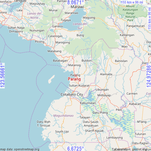
Parang GPS coordinates[2]
7° 22' 13.26" North, 124° 16' 11.028" East
| Map corner | latitude | longitude |
|---|---|---|
| Upper-left | 8.0671°, | 123.56661° |
| Center: | 7.37035°, | 124.26973° |
| Lower-right: | 6.6725°, | 124.97286° |
| Map W x H: | 155.1×155.1 km | = 96.4×96.4mi |
| max Lat: | 20.78733° ⇑87.9% North |
| Parang: | 7.37035° |
| min Lat: | ⇓12.1% South 4.65442° |
| min Long | Parang | max Long |
| 117.04868° | 124.26973° | 126.58417° |
| W 74.9%⇐ | ⇒25.1% E |
Elevation
Elevation of Parang is 57 m = 187 ft, and this is 30.9 m = 101 ft below average elevation for this country.
| Max E: |
2262 m = 7421 ft | 28% |
| Avg. | 87.9 m = 288 ft | |
| Parang | 57 m = 187 ft | |
Min E: |
-2 m = -7 ft | 72% |
See also: Parang elevation on elevation.city.
Geographical zone
Parang is located in North Torrid zone (between Equator and Tropic of Cancer). Distance of Equator is 819.5 km =509.2 mi to South.| Distance of | km | miles | from Parang |
|---|---|---|---|
| North Pole | 9187.6 | 5708.9 | to North |
| Arctic Circle | 6581.7 | 4089.7 | to North |
| Tropic Cancer | 1786.4 | 1110 | to North |
| Equator | 819.5 | 509.2 | to South |


Nearby cities:
15 places around Parang: (largest is in red/bold)
• Baka
10.5 km =6.5 mi,  183°
183°
• Barira
13.4 km =8.3 mi,  14°
14°
• Bualan
8.6 km =5.3 mi,  358°
358°
• Bugasan
7.9 km =4.9 mi,  351°
351°
• Dinganen
12.9 km =8 mi,  111°
111°
• Gang
13.9 km =8.6 mi, 181°
• Katuli
9.1 km =5.7 mi,  320°
320°
• Limbo
13.5 km =8.4 mi,  192°
192°
• Mataya
15.9 km =9.9 mi,  45°
45°
• Polloc
5.7 km =3.5 mi,  250°
250°
• Rominimbang
14.8 km =9.2 mi, 13°
• Sapadun
12.7 km =7.9 mi, 350°
• Simuay
11.1 km =6.9 mi,  158°
158°
• Sultan Kudarat
15.8 km =9.8 mi, 184°
• Tapayan
8.4 km =5.2 mi, 182°
Sources, notices
• [Note1] Compared only with cities in Philippines existing in our database
• [Src1] Map data: © OpenStreetMap contributors (CC-BY-SA)
• [Src2] Other city data from geonames.org with taken over terms of usage.
• [Src3] Geographical zone / Annual Mean Temperature by Robert A. Rohde @ Wikipedia
