Daguma geodata
Daguma (Soccsksargen) is a populated place; located in Philippines in Asia/Manila (GMT+8) time zone. With population of 3,785 people, there are 1856 cities with bigger population in this country. Compared to other cities in Philippines, 94.9% of cities are located further ↑North; 80.2% of cities are located further ←West and 77.7% of cities have lower elevation than Daguma. Note1
Administrative division(s):
- Level 1: Soccsksargen
- Level 2: Province of Sultan Kudarat
- Level 3: Bagumbayan


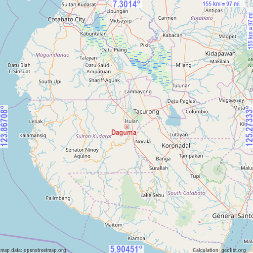
Daguma GPS coordinates[2]
6° 36' 12.42" North, 124° 34' 12.72" East
| Map corner | latitude | longitude |
|---|---|---|
| Upper-left | 7.3014°, | 123.86708° |
| Center: | 6.60345°, | 124.5702° |
| Lower-right: | 5.90451°, | 125.27333° |
| Map W x H: | 155.3×155.3 km | = 96.5×96.5mi |
| max Lat: | 20.78733° ⇑94.9% North |
| Daguma: | 6.60345° |
| min Lat: | ⇓5.1% South 4.65442° |
| min Long | Daguma | max Long |
| 117.04868° | 124.5702° | 126.58417° |
| W 80.2%⇐ | ⇒19.8% E |
Elevation
Elevation of Daguma is 79 m = 259 ft, and this is 8.9 m = 29 ft below average elevation for this country.
| Max E: |
2262 m = 7421 ft | 22.3% |
| Avg. | 87.9 m = 288 ft | |
| Daguma | 79 m = 259 ft | |
Min E: |
-2 m = -7 ft | 77.7% |
See also: Philippines elevation on elevation.city.
Geographical zone
Daguma is located in North Torrid zone (between Equator and Tropic of Cancer). Distance of Equator is 734.2 km =456.2 mi to South.| Distance of | km | miles | from Daguma |
|---|---|---|---|
| North Pole | 9272.8 | 5761.8 | to North |
| Arctic Circle | 6666.9 | 4142.6 | to North |
| Tropic Cancer | 1871.7 | 1163 | to North |
| Equator | 734.2 | 456.2 | to South |


Nearby cities:
15 places around Daguma: (largest is in red/bold)
• Biwang
3 km =1.9 mi,  275°
275°
• Busok
11.1 km =6.9 mi,  162°
162°
• Dansuli
4.4 km =2.7 mi,  18°
18°
• Dukay
7.2 km =4.5 mi,  348°
348°
• Dumaguil
9.4 km =5.8 mi,  78°
78°
• Isulan
4.8 km =3 mi,  53°
53°
• Kapaya
6.8 km =4.2 mi,  186°
186°
• Kapingkong
10.1 km =6.3 mi,  37°
37°
• Kolumbug
9.8 km =6.1 mi,  154°
154°
• Kudanding
7.1 km =4.4 mi,  103°
103°
• Laguilayan
9.1 km =5.7 mi,  326°
326°
• Liberty
11.5 km =7.1 mi,  143°
143°
• Matiompong
10.3 km =6.4 mi,  357°
357°
• Tuka
9.6 km =6 mi,  168°
168°
• Villamor
12.5 km =7.8 mi, 333°
Sources, notices
• [Note1] Compared only with cities in Philippines existing in our database
• [Src1] Map data: © OpenStreetMap contributors (CC-BY-SA)
• [Src2] Other city data from geonames.org with taken over terms of usage.
• [Src3] Geographical zone / Annual Mean Temperature by Robert A. Rohde @ Wikipedia
