Dumaguil geodata
Dumaguil (Soccsksargen) is a populated place; located in Philippines in Asia/Manila (GMT+8) time zone. With population of 2,239 people, there are 3805 cities with bigger population in this country. Compared to other cities in Philippines, 94.8% of cities are located further ↑North; 81.7% of cities are located further ←West and 77% of cities have lower elevation than Dumaguil. Note1
Administrative division(s):
- Level 1: Soccsksargen
- Level 2: Province of Sultan Kudarat
- Level 3: City of Tacurong


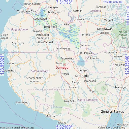
Dumaguil GPS coordinates[2]
6° 37' 12" North, 124° 39' 11.988" East
| Map corner | latitude | longitude |
|---|---|---|
| Upper-left | 7.31793°, | 123.95021° |
| Center: | 6.62°, | 124.65333° |
| Lower-right: | 5.92109°, | 125.35646° |
| Map W x H: | 155.3×155.3 km | = 96.5×96.5mi |
| max Lat: | 20.78733° ⇑94.8% North |
| Dumaguil: | 6.62° |
| min Lat: | ⇓5.2% South 4.65442° |
| min Long | Dumaguil | max Long |
| 117.04868° | 124.65333° | 126.58417° |
| W 81.7%⇐ | ⇒18.3% E |
Elevation
Elevation of Dumaguil is 75 m = 246 ft, and this is 12.9 m = 42 ft below average elevation for this country.
| Max E: |
2262 m = 7421 ft | 23% |
| Avg. | 87.9 m = 288 ft | |
| Dumaguil | 75 m = 246 ft | |
Min E: |
-2 m = -7 ft | 77% |
See also: Philippines elevation on elevation.city.
Geographical zone
Dumaguil is located in North Torrid zone (between Equator and Tropic of Cancer). Distance of Equator is 736.1 km =457.4 mi to South.| Distance of | km | miles | from Dumaguil |
|---|---|---|---|
| North Pole | 9271 | 5760.7 | to North |
| Arctic Circle | 6665.1 | 4141.5 | to North |
| Tropic Cancer | 1869.8 | 1161.8 | to North |
| Equator | 736.1 | 457.4 | to South |


Nearby cities:
15 places around Dumaguil: (largest is in red/bold)
• Biwang
12.2 km =7.6 mi,  262°
262°
• Daguma
9.4 km =5.8 mi, 258°
• Dansuli
8.1 km =5 mi,  286°
286°
• Dukay
11.9 km =7.4 mi,  296°
296°
• Gansing
11 km =6.8 mi,  0°
0°
• Isulan
5.4 km =3.4 mi,  281°
281°
• Kalandagan
10.2 km =6.3 mi,  50°
50°
• Kapingkong
6.8 km =4.2 mi,  334°
334°
• Kolumbug
11.8 km =7.3 mi,  204°
204°
• Kudanding
4.2 km =2.6 mi,  212°
212°
• Liberty
11.4 km =7.1 mi,  191°
191°
• New Lagao
9.3 km =5.8 mi,  351°
351°
• Norala
10.9 km =6.8 mi,  176°
176°
• Tacurong
8.5 km =5.3 mi,  17°
17°
• Tantangan
10.6 km =6.6 mi,  93°
93°
Sources, notices
• [Note1] Compared only with cities in Philippines existing in our database
• [Src1] Map data: © OpenStreetMap contributors (CC-BY-SA)
• [Src2] Other city data from geonames.org with taken over terms of usage.
• [Src3] Geographical zone / Annual Mean Temperature by Robert A. Rohde @ Wikipedia
