Kapingkong geodata
Kapingkong (Soccsksargen) is a populated place; located in Philippines in Asia/Manila (GMT+8) time zone. With population of 3,129 people, there are 2383 cities with bigger population in this country. Compared to other cities in Philippines, 94.3% of cities are located further ↑North; 81.3% of cities are located further ←West and 70.8% of cities have lower elevation than Kapingkong. Note1
Administrative division(s):
- Level 1: Soccsksargen
- Level 2: Province of Sultan Kudarat
- Level 3: City of Tacurong


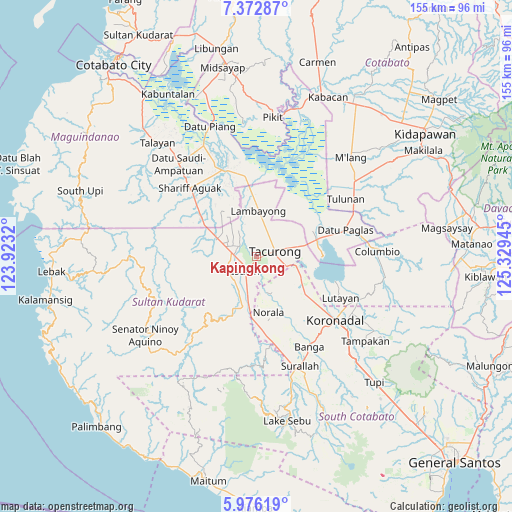
Kapingkong GPS coordinates[2]
6° 40' 30.108" North, 124° 37' 34.752" East
| Map corner | latitude | longitude |
|---|---|---|
| Upper-left | 7.37287°, | 123.9232° |
| Center: | 6.67503°, | 124.62632° |
| Lower-right: | 5.97619°, | 125.32945° |
| Map W x H: | 155.3×155.3 km | = 96.5×96.5mi |
| max Lat: | 20.78733° ⇑94.3% North |
| Kapingkong: | 6.67503° |
| min Lat: | ⇓5.7% South 4.65442° |
| min Long | Kapingkong | max Long |
| 117.04868° | 124.62632° | 126.58417° |
| W 81.3%⇐ | ⇒18.7% E |
Elevation
Elevation of Kapingkong is 54 m = 177 ft, and this is 33.9 m = 111 ft below average elevation for this country.
| Max E: |
2262 m = 7421 ft | 29.2% |
| Avg. | 87.9 m = 288 ft | |
| Kapingkong | 54 m = 177 ft | |
Min E: |
-2 m = -7 ft | 70.8% |
See also: Philippines elevation on elevation.city.
Geographical zone
Kapingkong is located in North Torrid zone (between Equator and Tropic of Cancer). Distance of Equator is 742.2 km =461.2 mi to South.| Distance of | km | miles | from Kapingkong |
|---|---|---|---|
| North Pole | 9264.9 | 5756.9 | to North |
| Arctic Circle | 6659 | 4137.7 | to North |
| Tropic Cancer | 1863.7 | 1158 | to North |
| Equator | 742.2 | 461.2 | to South |


Nearby cities:
15 places around Kapingkong: (largest is in red/bold)
• Daguma
10.1 km =6.3 mi,  217°
217°
• Dansuli
6.2 km =3.9 mi,  231°
231°
• Dukay
7.7 km =4.8 mi,  263°
263°
• Dumaguil
6.8 km =4.2 mi,  154°
154°
• Gansing
5.7 km =3.5 mi,  31°
31°
• Isulan
5.6 km =3.5 mi,  204°
204°
• Kalandagan
10.9 km =6.8 mi,  88°
88°
• Kudanding
9.7 km =6 mi,  175°
175°
• Mamali
11.2 km =7 mi,  12°
12°
• Mariano Marcos
7.9 km =4.9 mi, 34°
• Matiompong
7.1 km =4.4 mi,  289°
289°
• New Lagao
3.5 km =2.2 mi, 28°
• New Panay
10.5 km =6.5 mi,  315°
315°
• Tacurong
5.9 km =3.7 mi,  70°
70°
• Tambak
5.6 km =3.5 mi,  356°
356°
Sources, notices
• [Note1] Compared only with cities in Philippines existing in our database
• [Src1] Map data: © OpenStreetMap contributors (CC-BY-SA)
• [Src2] Other city data from geonames.org with taken over terms of usage.
• [Src3] Geographical zone / Annual Mean Temperature by Robert A. Rohde @ Wikipedia
