Bandhi geodata
Bandhi (Sindh) is a populated place; located in Pakistan in Asia/Karachi (GMT+5) time zone. With population of 8,608 people, there are 366 cities with bigger population in this country. Compared to other cities in Pakistan, 84.4% of cities are located further ↑North; 82.6% of cities are located further →East and 86.7% of cities have higher elevation than Bandhi. Note1


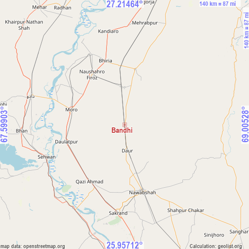
Bandhi GPS coordinates[2]
26° 35' 15.396" North, 68° 18' 7.74" East
| Map corner | latitude | longitude |
|---|---|---|
| Upper-left | 27.21464°, | 67.59903° |
| Center: | 26.58761°, | 68.30215° |
| Lower-right: | 25.95712°, | 69.00528° |
| Map W x H: | 139.8×139.8 km | = 86.9×86.9mi |
| max Lat: | 36.32162° ⇑84.4% North |
| Bandhi: | 26.58761° |
| min Lat: | ⇓15.6% South 24.14422° |
| min Long | Bandhi | max Long |
| 61.74573° | 68.30215° | 75.63372° |
| W 17.4%⇐ | ⇒82.6% E |
Elevation
Elevation of Bandhi is 39 m = 128 ft, and this is 306 m = 1004 ft below average elevation for this country.
| Max E: |
2732 m = 8963 ft | 86.7% |
| Avg. | 345 m = 1132 ft | |
| Bandhi | 39 m = 128 ft | |
Min E: |
3 m = 10 ft | 13.3% |
See also: Pakistan elevation on elevation.city.
Geographical zone
Bandhi is located in North temperate zone (between Tropic of Cancer and the Arctic Circle). Distance of this Northern Tropic circle is 350.3 km =217.7 mi to South.| Distance of | km | miles | from Bandhi |
|---|---|---|---|
| North Pole | 7050.8 | 4381.2 | to North |
| Arctic Circle | 4444.9 | 2761.9 | to North |
| Tropic Cancer | 350.3 | 217.7 | to South |
| Equator | 2956.3 | 1837 | to South |


Nearby cities:
15 places around Bandhi: (largest is in red/bold)
• Bhiria
37.4 km =23.2 mi,  343°
343°
• Darya Khan Marri
10.1 km =6.3 mi,  351°
351°
• Daulatpur
34.3 km =21.3 mi,  253°
253°
• Daur
14.8 km =9.2 mi,  173°
173°
• Jām Sāhib
46 km =28.6 mi,  134°
134°
• Kandiari
42.5 km =26.4 mi,  30°
30°
• Kandiaro
53.2 km =33.1 mi, 350°
• Karaundi
35.9 km =22.3 mi,  16°
16°
• Moro
31.2 km =19.4 mi,  285°
285°
• Naushahro Firoz
33.3 km =20.7 mi,  327°
327°
• Nawabshah
40 km =24.9 mi, 165°
• Pad Idan
20.8 km =12.9 mi,  359°
359°
• Sakrand
50 km =31.1 mi,  183°
183°
• Sehwan
47.5 km =29.5 mi, 247°
• Tharu Shah
43.5 km =27 mi, 335°
Sources, notices
• [Note1] Compared only with cities in Pakistan existing in our database
• [Src1] Map data: © OpenStreetMap contributors (CC-BY-SA)
• [Src2] Other city data from geonames.org with taken over terms of usage.
• [Src3] Geographical zone / Annual Mean Temperature by Robert A. Rohde @ Wikipedia
