Przytkowice geodata
Przytkowice (Lesser Poland) is a populated place; located in Poland in Europe/Warsaw (GMT+2) time zone. With population of 2,560 people, there are 1219 cities with bigger population in this country. Compared to other cities in Poland, 86.7% of cities are located further ↑North; 52.5% of cities are located further ←West and 90% of cities have lower elevation than Przytkowice. Note1
Administrative division(s):
- Level 1: Lesser Poland
- Level 2: Powiat wadowicki
- Level 3: Kalwaria Zebrzydowska


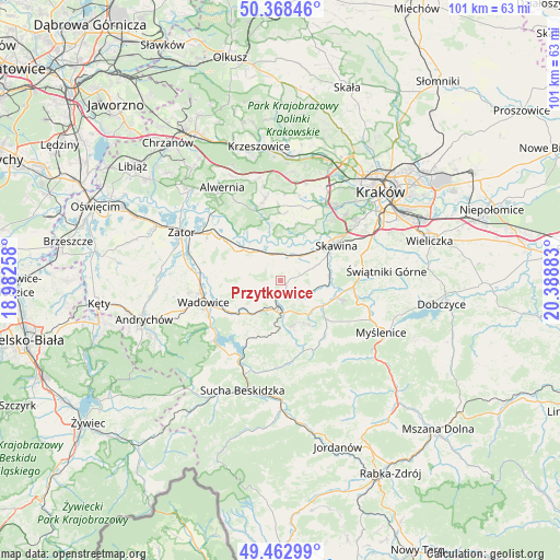
Przytkowice GPS coordinates[2]
49° 55' 4.26" North, 19° 41' 8.52" East
| Map corner | latitude | longitude |
|---|---|---|
| Upper-left | 50.36846°, | 18.98258° |
| Center: | 49.91785°, | 19.6857° |
| Lower-right: | 49.46299°, | 20.38883° |
| Map W x H: | 100.7×100.7 km | = 62.6×62.6mi |
| max Lat: | 54.83135° ⇑86.7% North |
| Przytkowice: | 49.91785° |
| min Lat: | ⇓13.3% South 49.21328° |
| min Long | Przytkowice | max Long |
| 14.20249° | 19.6857° | 24.03723° |
| W 52.5%⇐ | ⇒47.5% E |
Elevation
Elevation of Przytkowice is 328 m = 1076 ft, and this is 136.6 m = 448 ft above average elevation for this country.
| Max E: |
974 m = 3196 ft | 10% |
| Przytkowice | 328 m 1076 ft | |
| Avg. | 191.4 m = 628 ft | |
Min E: |
-3 m = -10 ft | 90% |
See also: Poland elevation on elevation.city.
Geographical zone
Przytkowice is located in North temperate zone (between Tropic of Cancer and the Arctic Circle). Distance of this North polar circle is 1850.8 km =1150 mi to North.| Distance of | km | miles | from Przytkowice |
|---|---|---|---|
| North Pole | 4456.7 | 2769.3 | to North |
| Arctic Circle | 1850.8 | 1150 | to North |
| Tropic Cancer | 2944.4 | 1829.6 | to South |
| Equator | 5550.3 | 3448.8 | to South |


Nearby cities:
15 places around Przytkowice: (largest is in red/bold)
• Brody
5.7 km =3.5 mi,  171°
171°
• Bęczyn
2.7 km =1.7 mi,  316°
316°
• Facimiech
6 km =3.7 mi,  24°
24°
• Kalwaria Zebrzydowska
5.6 km =3.5 mi,  186°
186°
• Krzęcin
4.9 km =3 mi,  54°
54°
• Leńcze
4.1 km =2.5 mi,  120°
120°
• Marcyporęba
6 km =3.7 mi,  300°
300°
• Paszkówka
2.4 km =1.5 mi,  346°
346°
• Pozowice
6.3 km =3.9 mi,  8°
8°
• Sosnowice
3.2 km =2 mi,  40°
40°
• Stanisław Dolny
2.7 km =1.7 mi,  237°
237°
• Stanisław Górny
4.1 km =2.5 mi,  260°
260°
• Wysoka
6 km =3.7 mi, 258°
• Zarzyce Wielkie
5.2 km =3.2 mi,  141°
141°
• Zebrzydowice
3.2 km =2 mi,  196°
196°
Sources, notices
• [Note1] Compared only with cities in Poland existing in our database
• [Src1] Map data: © OpenStreetMap contributors (CC-BY-SA)
• [Src2] Other city data from geonames.org with taken over terms of usage.
• [Src3] Geographical zone / Annual Mean Temperature by Robert A. Rohde @ Wikipedia
