Podsarnie geodata
Podsarnie (Lesser Poland) is a populated place; located in Poland in Europe/Warsaw (GMT+2) time zone. With population of 803 people, there are 2848 cities with bigger population in this country. Compared to other cities in Poland, 97.6% of cities are located further ↑North; 54.6% of cities are located further ←West and 99.8% of cities have lower elevation than Podsarnie. Note1


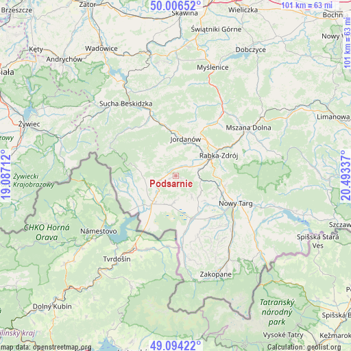
Podsarnie GPS coordinates[2]
49° 33' 9" North, 19° 47' 24.864" East
| Map corner | latitude | longitude |
|---|---|---|
| Upper-left | 50.00652°, | 19.08712° |
| Center: | 49.5525°, | 19.79024° |
| Lower-right: | 49.09422°, | 20.49337° |
| Map W x H: | 101.4×101.4 km | = 63×63mi |
| max Lat: | 54.83135° ⇑97.6% North |
| Podsarnie: | 49.5525° |
| min Lat: | ⇓2.4% South 49.21328° |
| min Long | Podsarnie | max Long |
| 14.20249° | 19.79024° | 24.03723° |
| W 54.6%⇐ | ⇒45.4% E |
Elevation
Elevation of Podsarnie is 724 m = 2375 ft, and this is 532.6 m = 1747 ft above average elevation for this country.
| Max E: |
974 m = 3196 ft | 0.2% |
| Podsarnie | 724 m 2375 ft | |
| Avg. | 191.4 m = 628 ft | |
Min E: |
-3 m = -10 ft | 99.8% |
See also: Poland elevation on elevation.city.
Geographical zone
Podsarnie is located in North temperate zone (between Tropic of Cancer and the Arctic Circle). Distance of this North polar circle is 1891.5 km =1175.3 mi to North.| Distance of | km | miles | from Podsarnie |
|---|---|---|---|
| North Pole | 4497.3 | 2794.5 | to North |
| Arctic Circle | 1891.5 | 1175.3 | to North |
| Tropic Cancer | 2903.8 | 1804.3 | to South |
| Equator | 5509.7 | 3423.6 | to South |


Nearby cities:
15 places around Podsarnie: (largest is in red/bold)
• Harkabuz
3.6 km =2.2 mi,  115°
115°
• Odrowąż
7.7 km =4.8 mi,  143°
143°
• Orawka
6.4 km =4 mi,  228°
228°
• Piekielnik
8.6 km =5.3 mi,  190°
190°
• Pieniążkowice
8.9 km =5.5 mi,  132°
132°
• Podwilk
3.8 km =2.4 mi,  261°
261°
• Raba Wyżna
6.6 km =4.1 mi,  76°
76°
• Rokiciny
9.8 km =6.1 mi, 76°
• Sidzina
7.2 km =4.5 mi,  307°
307°
• Sieniawa
10.2 km =6.3 mi,  98°
98°
• Spytkowice
4.2 km =2.6 mi,  48°
48°
• Toporzysko
8.1 km =5 mi,  6°
6°
• Wysoka
8.5 km =5.3 mi,  29°
29°
• Załuczne
7 km =4.3 mi,  163°
163°
• Zubrzyca Dolna
8.9 km =5.5 mi,  251°
251°
Sources, notices
• [Note1] Compared only with cities in Poland existing in our database
• [Src1] Map data: © OpenStreetMap contributors (CC-BY-SA)
• [Src2] Other city data from geonames.org with taken over terms of usage.
• [Src3] Geographical zone / Annual Mean Temperature by Robert A. Rohde @ Wikipedia
