Załuczne geodata
Załuczne (Lesser Poland) is a populated place; located in Poland in Europe/Warsaw (GMT+2) time zone. With population of 678 people, there are 3117 cities with bigger population in this country. Compared to other cities in Poland, 98.3% of cities are located further ↑North; 55.2% of cities are located further ←West and 99.6% of cities have lower elevation than Załuczne. Note1
Administrative division(s):
- Level 1: Lesser Poland
- Level 2: Powiat nowotarski
- Level 3: Czarny Dunajec


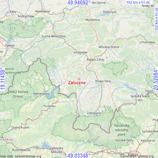
Załuczne GPS coordinates[2]
49° 29' 32.388" North, 19° 49' 3.756" East
| Map corner | latitude | longitude |
|---|---|---|
| Upper-left | 49.94692°, | 19.11459° |
| Center: | 49.49233°, | 19.81771° |
| Lower-right: | 49.03348°, | 20.52084° |
| Map W x H: | 101.6×101.6 km | = 63.1×63.1mi |
| max Lat: | 54.83135° ⇑98.3% North |
| Załuczne: | 49.49233° |
| min Lat: | ⇓1.7% South 49.21328° |
| min Long | Załuczne | max Long |
| 14.20249° | 19.81771° | 24.03723° |
| W 55.2%⇐ | ⇒44.8% E |
Elevation
Elevation of Załuczne is 688 m = 2257 ft, and this is 496.6 m = 1629 ft above average elevation for this country.
| Max E: |
974 m = 3196 ft | 0.40000000000001% |
| Załuczne | 688 m 2257 ft | |
| Avg. | 191.4 m = 628 ft | |
Min E: |
-3 m = -10 ft | 99.6% |
See also: Poland elevation on elevation.city.
Geographical zone
Załuczne is located in North temperate zone (between Tropic of Cancer and the Arctic Circle). Distance of this North polar circle is 1898.1 km =1179.4 mi to North.| Distance of | km | miles | from Załuczne |
|---|---|---|---|
| North Pole | 4504 | 2798.7 | to North |
| Arctic Circle | 1898.1 | 1179.4 | to North |
| Tropic Cancer | 2897.1 | 1800.2 | to South |
| Equator | 5503 | 3419.4 | to South |


Nearby cities:
15 places around Załuczne: (largest is in red/bold)
• Czarny Dunajec
6.7 km =4.2 mi,  158°
158°
• Harkabuz
5.3 km =3.3 mi,  14°
14°
• Jabłonka
9.1 km =5.7 mi,  261°
261°
• Krauszów
10.2 km =6.3 mi,  101°
101°
• Odrowąż
2.6 km =1.6 mi,  79°
79°
• Orawka
7.2 km =4.5 mi,  289°
289°
• Piekielnik
4 km =2.5 mi,  244°
244°
• Pieniążkowice
4.6 km =2.9 mi, 82°
• Podsarnie
7 km =4.3 mi,  343°
343°
• Podwilk
8.4 km =5.2 mi,  317°
317°
• Pyzówka
9 km =5.6 mi,  73°
73°
• Raba Wyżna
9.4 km =5.8 mi,  28°
28°
• Sieniawa
9.7 km =6 mi,  57°
57°
• Spytkowice
9.5 km =5.9 mi, 6°
• Wróblówka
6.7 km =4.2 mi,  129°
129°
Sources, notices
• [Note1] Compared only with cities in Poland existing in our database
• [Src1] Map data: © OpenStreetMap contributors (CC-BY-SA)
• [Src2] Other city data from geonames.org with taken over terms of usage.
• [Src3] Geographical zone / Annual Mean Temperature by Robert A. Rohde @ Wikipedia
