Spytkowice geodata
Spytkowice (Lesser Poland) is a seat of a third-order administrative division; located in Poland in Europe/Warsaw (GMT+2) time zone. With population of 3,390 people, there are 943 cities with bigger population in this country. Compared to other cities in Poland, 96.9% of cities are located further ↑North; 55.6% of cities are located further ←West and 97.8% of cities have lower elevation than Spytkowice. Note1


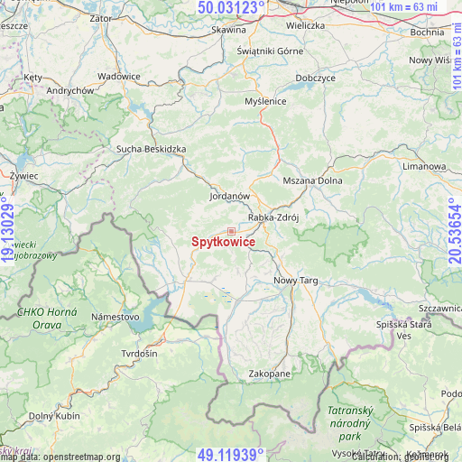
Spytkowice GPS coordinates[2]
49° 34' 38.784" North, 19° 50' 0.276" East
| Map corner | latitude | longitude |
|---|---|---|
| Upper-left | 50.03123°, | 19.13029° |
| Center: | 49.57744°, | 19.83341° |
| Lower-right: | 49.11939°, | 20.53654° |
| Map W x H: | 101.4×101.4 km | = 63×63mi |
| max Lat: | 54.83135° ⇑96.9% North |
| Spytkowice: | 49.57744° |
| min Lat: | ⇓3.1% South 49.21328° |
| min Long | Spytkowice | max Long |
| 14.20249° | 19.83341° | 24.03723° |
| W 55.6%⇐ | ⇒44.4% E |
Elevation
Elevation of Spytkowice is 522 m = 1713 ft, and this is 330.6 m = 1085 ft above average elevation for this country.
| Max E: |
974 m = 3196 ft | 2.2% |
| Spytkowice | 522 m 1713 ft | |
| Avg. | 191.4 m = 628 ft | |
Min E: |
-3 m = -10 ft | 97.8% |
See also: Poland elevation on elevation.city.
Geographical zone
Spytkowice is located in North temperate zone (between Tropic of Cancer and the Arctic Circle). Distance of this North polar circle is 1888.7 km =1173.6 mi to North.| Distance of | km | miles | from Spytkowice |
|---|---|---|---|
| North Pole | 4494.6 | 2792.8 | to North |
| Arctic Circle | 1888.7 | 1173.6 | to North |
| Tropic Cancer | 2906.6 | 1806.1 | to South |
| Equator | 5512.5 | 3425.3 | to South |


Nearby cities:
15 places around Spytkowice: (largest is in red/bold)
• Bystra
8.7 km =5.4 mi,  333°
333°
• Harkabuz
4.4 km =2.7 mi,  177°
177°
• Jordanów
8 km =5 mi,  358°
358°
• Naprawa
8.4 km =5.2 mi,  23°
23°
• Odrowąż
9.1 km =5.7 mi,  170°
170°
• Pieniążkowice
9.5 km =5.9 mi,  159°
159°
• Podsarnie
4.2 km =2.6 mi,  228°
228°
• Podwilk
7.6 km =4.7 mi,  244°
244°
• Raba Wyżna
3.5 km =2.2 mi,  109°
109°
• Rokiciny
6.5 km =4 mi,  94°
94°
• Sidzina
8.9 km =5.5 mi,  280°
280°
• Sieniawa
8.2 km =5.1 mi,  121°
121°
• Toporzysko
5.7 km =3.5 mi,  336°
336°
• Wysoka
4.8 km =3 mi,  12°
12°
• Załuczne
9.5 km =5.9 mi,  186°
186°
Sources, notices
• [Note1] Compared only with cities in Poland existing in our database
• [Src1] Map data: © OpenStreetMap contributors (CC-BY-SA)
• [Src2] Other city data from geonames.org with taken over terms of usage.
• [Src3] Geographical zone / Annual Mean Temperature by Robert A. Rohde @ Wikipedia
