Tryńcza geodata
Tryńcza (Subcarpathian) is a seat of a third-order administrative division; located in Poland in Europe/Warsaw (GMT+2) time zone. With population of 1,325 people, there are 2035 cities with bigger population in this country. Compared to other cities in Poland, 75.5% of cities are located further ↑North; 92.2% of cities are located further ←West and 51.2% of cities have lower elevation than Tryńcza. Note1


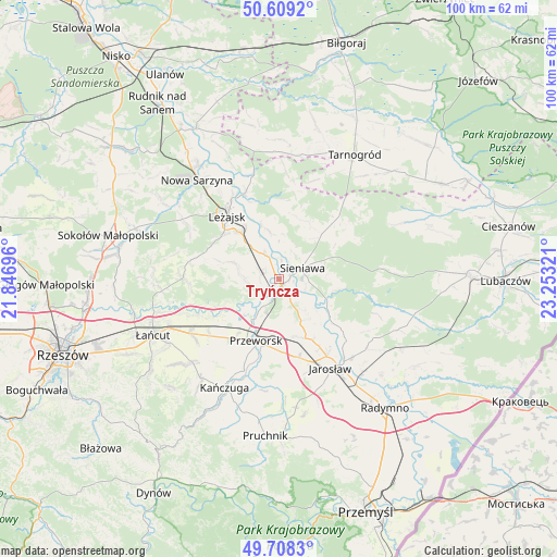
Tryńcza GPS coordinates[2]
50° 9' 39.132" North, 22° 33' 0.288" East
| Map corner | latitude | longitude |
|---|---|---|
| Upper-left | 50.6092°, | 21.84696° |
| Center: | 50.16087°, | 22.55008° |
| Lower-right: | 49.7083°, | 23.25321° |
| Map W x H: | 100.2×100.2 km | = 62.3×62.3mi |
| max Lat: | 54.83135° ⇑75.5% North |
| Tryńcza: | 50.16087° |
| min Lat: | ⇓24.5% South 49.21328° |
| min Long | Tryńcza | max Long |
| 14.20249° | 22.55008° | 24.03723° |
| W 92.2%⇐ | ⇒7.8% E |
Elevation
Elevation of Tryńcza is 175 m = 574 ft, and this is 16.4 m = 54 ft below average elevation for this country.
| Max E: |
974 m = 3196 ft | 48.8% |
| Avg. | 191.4 m = 628 ft | |
| Tryńcza | 175 m = 574 ft | |
Min E: |
-3 m = -10 ft | 51.2% |
See also: Poland elevation on elevation.city.
Geographical zone
Tryńcza is located in North temperate zone (between Tropic of Cancer and the Arctic Circle). Distance of this North polar circle is 1823.8 km =1133.3 mi to North.| Distance of | km | miles | from Tryńcza |
|---|---|---|---|
| North Pole | 4429.7 | 2752.5 | to North |
| Arctic Circle | 1823.8 | 1133.3 | to North |
| Tropic Cancer | 2971.4 | 1846.3 | to South |
| Equator | 5577.4 | 3465.6 | to South |


Nearby cities:
15 places around Tryńcza: (largest is in red/bold)
• Dębno
4.7 km =2.9 mi,  331°
331°
• Gorliczyna
8.8 km =5.5 mi,  210°
210°
• Gorzyce
4.2 km =2.6 mi,  150°
150°
• Grodzisko Dolne
6.2 km =3.9 mi,  271°
271°
• Grodzisko Górne
8.5 km =5.3 mi,  289°
289°
• Grzęska
11 km =6.8 mi,  218°
218°
• Jagiełła
7.5 km =4.7 mi,  167°
167°
• Leżachów
5.2 km =3.2 mi,  109°
109°
• Piskorowice
8.5 km =5.3 mi,  349°
349°
• Sieniawa
4.6 km =2.9 mi,  65°
65°
• Ubieszyn
2.2 km =1.4 mi,  79°
79°
• Ujezna
10.7 km =6.6 mi,  164°
164°
• Wylewa
6.2 km =3.9 mi,  56°
56°
• Wólka Grodziska
11 km =6.8 mi, 286°
• Wólka Pełkińska
9 km =5.6 mi,  144°
144°
Sources, notices
• [Note1] Compared only with cities in Poland existing in our database
• [Src1] Map data: © OpenStreetMap contributors (CC-BY-SA)
• [Src2] Other city data from geonames.org with taken over terms of usage.
• [Src3] Geographical zone / Annual Mean Temperature by Robert A. Rohde @ Wikipedia
