Zalesie geodata
Zalesie (Lublin) is a seat of a third-order administrative division; located in Poland in Europe/Warsaw (GMT+2) time zone. In our database, there are 3649 cities with bigger population. Compared to other cities in Poland, 66.3% of cities are located further ↓South; 98.3% of cities are located further ←West and 62.4% of cities have higher elevation than Zalesie. Note1


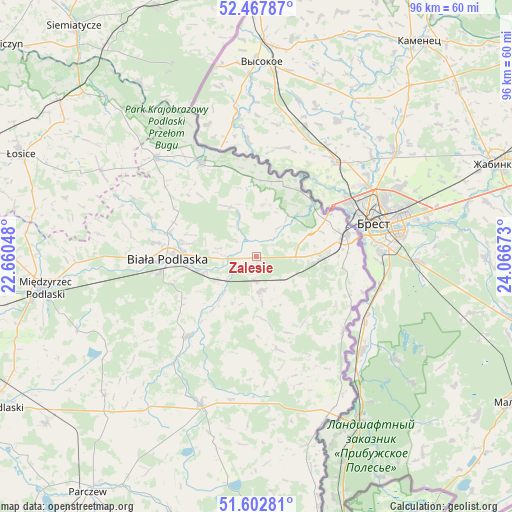
Zalesie GPS coordinates[2]
52° 2' 14.748" North, 23° 21' 48.96" East
| Map corner | latitude | longitude |
|---|---|---|
| Upper-left | 52.46787°, | 22.66048° |
| Center: | 52.03743°, | 23.3636° |
| Lower-right: | 51.60281°, | 24.06673° |
| Map W x H: | 96.2×96.2 km | = 59.8×59.8mi |
| max Lat: | 54.83135° ⇑33.7% North |
| Zalesie: | 52.03743° |
| min Lat: | ⇓66.3% South 49.21328° |
| min Long | Zalesie | max Long |
| 14.20249° | 23.3636° | 24.03723° |
| W 98.3%⇐ | ⇒1.7% E |
Elevation
Elevation of Zalesie is 141 m = 463 ft, and this is 50.4 m = 165 ft below average elevation for this country.
| Max E: |
974 m = 3196 ft | 62.4% |
| Avg. | 191.4 m = 628 ft | |
| Zalesie | 141 m = 463 ft | |
Min E: |
-3 m = -10 ft | 37.6% |
See also: Poland elevation on elevation.city.
Geographical zone
Zalesie is located in North temperate zone (between Tropic of Cancer and the Arctic Circle). Distance of this North polar circle is 1615.2 km =1003.6 mi to North.| Distance of | km | miles | from Zalesie |
|---|---|---|---|
| North Pole | 4221 | 2622.8 | to North |
| Arctic Circle | 1615.2 | 1003.6 | to North |
| Tropic Cancer | 3180.1 | 1976 | to South |
| Equator | 5786 | 3595.3 | to South |


Nearby cities:
15 places around Zalesie: (largest is in red/bold)
• Biała Podlaska
16.9 km =10.5 mi,  268°
268°
• Janów Podlaski
20.2 km =12.6 mi,  329°
329°
• Kodeń
21.5 km =13.4 mi,  130°
130°
• Konstantynów
26.8 km =16.7 mi,  314°
314°
• Kostomłoty
21.1 km =13.1 mi,  108°
108°
• Leśna Podlaska
25.3 km =15.7 mi,  294°
294°
• Piszczac
6.3 km =3.9 mi,  171°
171°
• Rokitno
10.4 km =6.5 mi, 333°
• Rossosz
25.2 km =15.7 mi,  217°
217°
• Sosnówka
31.9 km =19.8 mi,  183°
183°
• Sławatycze
33.2 km =20.6 mi,  156°
156°
• Terespol
17.8 km =11.1 mi,  76°
76°
• Tuczna
18 km =11.2 mi, 166°
• Wisznice
29.6 km =18.4 mi,  201°
201°
• Łomazy
19.6 km =12.2 mi, 220°
Sources, notices
• [Note1] Compared only with cities in Poland existing in our database
• [Src1] Map data: © OpenStreetMap contributors (CC-BY-SA)
• [Src2] Other city data from geonames.org with taken over terms of usage.
• [Src3] Geographical zone / Annual Mean Temperature by Robert A. Rohde @ Wikipedia
