Kluszkowce geodata
Kluszkowce (Lesser Poland) is a populated place; located in Poland in Europe/Warsaw (GMT+2) time zone. With population of 1,820 people, there are 1599 cities with bigger population in this country. Compared to other cities in Poland, 99% of cities are located further ↑North; 62.6% of cities are located further ←West and 98.2% of cities have lower elevation than Kluszkowce. Note1


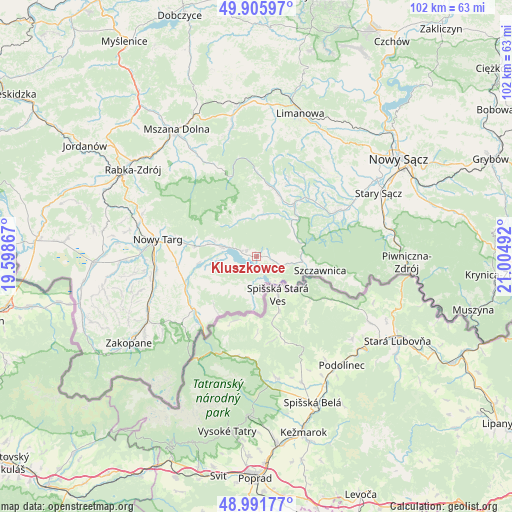
Kluszkowce GPS coordinates[2]
49° 27' 3.6" North, 20° 18' 6.444" East
| Map corner | latitude | longitude |
|---|---|---|
| Upper-left | 49.90597°, | 19.59867° |
| Center: | 49.451°, | 20.30179° |
| Lower-right: | 48.99177°, | 21.00492° |
| Map W x H: | 101.6×101.6 km | = 63.1×63.1mi |
| max Lat: | 54.83135° ⇑99% North |
| Kluszkowce: | 49.451° |
| min Lat: | ⇓1% South 49.21328° |
| min Long | Kluszkowce | max Long |
| 14.20249° | 20.30179° | 24.03723° |
| W 62.6%⇐ | ⇒37.4% E |
Elevation
Elevation of Kluszkowce is 552 m = 1811 ft, and this is 360.6 m = 1183 ft above average elevation for this country.
| Max E: |
974 m = 3196 ft | 1.8% |
| Kluszkowce | 552 m 1811 ft | |
| Avg. | 191.4 m = 628 ft | |
Min E: |
-3 m = -10 ft | 98.2% |
See also: Poland elevation on elevation.city.
Geographical zone
Kluszkowce is located in North temperate zone (between Tropic of Cancer and the Arctic Circle). Distance of this North polar circle is 1902.7 km =1182.3 mi to North.| Distance of | km | miles | from Kluszkowce |
|---|---|---|---|
| North Pole | 4508.6 | 2801.5 | to North |
| Arctic Circle | 1902.7 | 1182.3 | to North |
| Tropic Cancer | 2892.5 | 1797.3 | to South |
| Equator | 5498.4 | 3416.5 | to South |


Nearby cities:
15 places around Kluszkowce: (largest is in red/bold)
• Czarna Góra
14.9 km =9.3 mi,  236°
236°
• Dębno
7.1 km =4.4 mi,  283°
283°
• Frydman
5.2 km =3.2 mi,  267°
267°
• Kamienica
14.2 km =8.8 mi,  12°
12°
• Krościenko nad Dunajcem
9.1 km =5.7 mi,  97°
97°
• Krośnica
2.8 km =1.7 mi, 97°
• Maniowy
2.9 km =1.8 mi,  289°
289°
• Niedzica
4.6 km =2.9 mi,  179°
179°
• Ochotnica Dolna
8.9 km =5.5 mi,  19°
19°
• Ostrowsko
14.8 km =9.2 mi, 280°
• Szczawnica
13.6 km =8.5 mi, 102°
• Szlembark
7 km =4.3 mi, 292°
• Łapsze Niżne
7.2 km =4.5 mi,  215°
215°
• Łopuszna
12.6 km =7.8 mi, 281°
• Łącko
15.3 km =9.5 mi,  39°
39°
Sources, notices
• [Note1] Compared only with cities in Poland existing in our database
• [Src1] Map data: © OpenStreetMap contributors (CC-BY-SA)
• [Src2] Other city data from geonames.org with taken over terms of usage.
• [Src3] Geographical zone / Annual Mean Temperature by Robert A. Rohde @ Wikipedia
