Kamienica geodata
Kamienica (Lesser Poland) is a populated place; located in Poland in Europe/Warsaw (GMT+2) time zone. With population of 3,100 people, there are 1018 cities with bigger population in this country. Compared to other cities in Poland, 97% of cities are located further ↑North; 63.2% of cities are located further ←West and 96.2% of cities have lower elevation than Kamienica. Note1


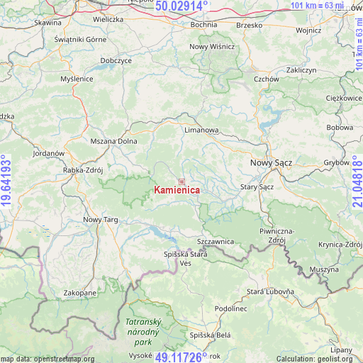
Kamienica GPS coordinates[2]
49° 34' 31.188" North, 20° 20' 42.18" East
| Map corner | latitude | longitude |
|---|---|---|
| Upper-left | 50.02914°, | 19.64193° |
| Center: | 49.57533°, | 20.34505° |
| Lower-right: | 49.11726°, | 21.04818° |
| Map W x H: | 101.4×101.4 km | = 63×63mi |
| max Lat: | 54.83135° ⇑97% North |
| Kamienica: | 49.57533° |
| min Lat: | ⇓3% South 49.21328° |
| min Long | Kamienica | max Long |
| 14.20249° | 20.34505° | 24.03723° |
| W 63.2%⇐ | ⇒36.8% E |
Elevation
Elevation of Kamienica is 448 m = 1470 ft, and this is 256.6 m = 842 ft above average elevation for this country.
| Max E: |
974 m = 3196 ft | 3.8% |
| Kamienica | 448 m 1470 ft | |
| Avg. | 191.4 m = 628 ft | |
Min E: |
-3 m = -10 ft | 96.2% |
See also: Poland elevation on elevation.city.
Geographical zone
Kamienica is located in North temperate zone (between Tropic of Cancer and the Arctic Circle). Distance of this North polar circle is 1888.9 km =1173.7 mi to North.| Distance of | km | miles | from Kamienica |
|---|---|---|---|
| North Pole | 4494.8 | 2792.9 | to North |
| Arctic Circle | 1888.9 | 1173.7 | to North |
| Tropic Cancer | 2906.3 | 1805.9 | to South |
| Equator | 5512.3 | 3425.2 | to South |


Nearby cities:
15 places around Kamienica: (largest is in red/bold)
• Jastrzębie
9.8 km =6.1 mi,  78°
78°
• Kluszkowce
14.2 km =8.8 mi,  192°
192°
• Krośnica
14.2 km =8.8 mi,  181°
181°
• Lubomierz
10.9 km =6.8 mi,  289°
289°
• Maniowy
14.1 km =8.8 mi,  204°
204°
• Naszacowice
15.2 km =9.4 mi,  94°
94°
• Ochotnica Dolna
5.4 km =3.4 mi, 181°
• Olszana
12.7 km =7.9 mi, 93°
• Olszanka
14.4 km =8.9 mi,  98°
98°
• Szlembark
14.7 km =9.1 mi,  220°
220°
• Słopnice
12.2 km =7.6 mi,  359°
359°
• Wilczyce
14.5 km =9 mi,  314°
314°
• Zagorzyn
4.5 km =2.8 mi, 86°
• Łukowica
10.7 km =6.6 mi,  68°
68°
• Łącko
6.8 km =4.2 mi,  106°
106°
Sources, notices
• [Note1] Compared only with cities in Poland existing in our database
• [Src1] Map data: © OpenStreetMap contributors (CC-BY-SA)
• [Src2] Other city data from geonames.org with taken over terms of usage.
• [Src3] Geographical zone / Annual Mean Temperature by Robert A. Rohde @ Wikipedia
