Bemowo geodata
Bemowo (Mazovia) is a populated place; located in Poland in Europe/Warsaw (GMT+2) time zone. With population of 102,393 people, there are 46 cities with bigger population in this country. Compared to other cities in Poland, 71.6% of cities are located further ↓South; 70.9% of cities are located further ←West and 76% of cities have higher elevation than Bemowo. Note1


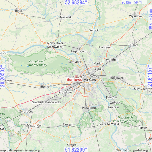
Bemowo GPS coordinates[2]
52° 15' 16.56" North, 20° 54' 30.384" East
| Map corner | latitude | longitude |
|---|---|---|
| Upper-left | 52.68294°, | 20.20532° |
| Center: | 52.2546°, | 20.90844° |
| Lower-right: | 51.82209°, | 21.61157° |
| Map W x H: | 95.7×95.7 km | = 59.5×59.5mi |
| max Lat: | 54.83135° ⇑28.4% North |
| Bemowo: | 52.2546° |
| min Lat: | ⇓71.6% South 49.21328° |
| min Long | Bemowo | max Long |
| 14.20249° | 20.90844° | 24.03723° |
| W 70.9%⇐ | ⇒29.1% E |
Elevation
Elevation of Bemowo is 108 m = 354 ft, and this is 83.4 m = 274 ft below average elevation for this country.
| Max E: |
974 m = 3196 ft | 76% |
| Avg. | 191.4 m = 628 ft | |
| Bemowo | 108 m = 354 ft | |
Min E: |
-3 m = -10 ft | 24% |
See also: Bemowo elevation on elevation.city.
Geographical zone
Bemowo is located in North temperate zone (between Tropic of Cancer and the Arctic Circle). Distance of this North polar circle is 1591 km =988.6 mi to North.| Distance of | km | miles | from Bemowo |
|---|---|---|---|
| North Pole | 4196.9 | 2607.8 | to North |
| Arctic Circle | 1591 | 988.6 | to North |
| Tropic Cancer | 3204.2 | 1991 | to South |
| Equator | 5810.2 | 3610.3 | to South |


Nearby cities:
15 places around Bemowo: (largest is in red/bold)
• Babice
4 km =2.5 mi,  263°
263°
• Białołeka
8.6 km =5.3 mi,  30°
30°
• Bielany
4.6 km =2.9 mi,  23°
23°
• Hornówek
7.7 km =4.8 mi,  297°
297°
• Izabelin
8 km =5 mi,  309°
309°
• Ochota
6.4 km =4 mi,  125°
125°
• Praga Północ
8.6 km =5.3 mi,  90°
90°
• Stare Babice
5.1 km =3.2 mi,  277°
277°
• Ursus
6.8 km =4.2 mi,  194°
194°
• Warsaw
7.6 km =4.7 mi,  111°
111°
• Wola
5.7 km =3.5 mi, 106°
• Włochy
8.7 km =5.4 mi,  162°
162°
• Zielonki-Wieś
7 km =4.3 mi,  268°
268°
• Śródmieście
7.9 km =4.9 mi, 111°
• Żoliborz
5.5 km =3.4 mi,  73°
73°
Sources, notices
• [Note1] Compared only with cities in Poland existing in our database
• [Src1] Map data: © OpenStreetMap contributors (CC-BY-SA)
• [Src2] Other city data from geonames.org with taken over terms of usage.
• [Src3] Geographical zone / Annual Mean Temperature by Robert A. Rohde @ Wikipedia
