Boaventura geodata
Boaventura (Madeira) is a populated place; located in Portugal in Atlantic/Madeira (GMT+0) time zone. With population of 1,221 people, there are 723 cities with bigger population in this country. Compared to other cities in Portugal, 96.5% of cities are located further ↑North; 91.3% of cities are located further →East and 53.2% of cities have lower elevation than Boaventura. Note1


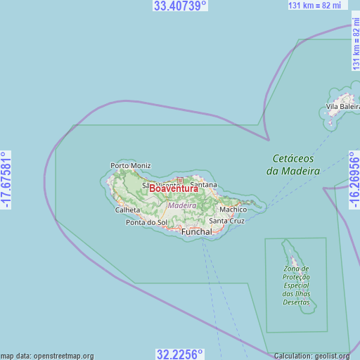
Boaventura GPS coordinates[2]
32° 49' 6.456" North, 16° 58' 21.648" West
| Map corner | latitude | longitude |
|---|---|---|
| Upper-left | 33.40739°, | -17.67581° |
| Center: | 32.81846°, | -16.97268° |
| Lower-right: | 32.2256°, | -16.26956° |
| Map W x H: | 131.4×131.4 km | = 81.6×81.6mi |
| max Lat: | 42.11337° ⇑96.5% North |
| Boaventura: | 32.81846° |
| min Lat: | ⇓3.5% South 32.6448° |
| min Long | Boaventura | max Long |
| -31.17847° | -16.97268° | -6.27308° |
| W 8.7%⇐ | ⇒91.3% E |
Elevation
Elevation of Boaventura is 123 m = 404 ft, and this is 54 m = 177 ft below average elevation for this country.
| Max E: |
1008 m = 3307 ft | 46.8% |
| Avg. | 177 m = 581 ft | |
| Boaventura | 123 m = 404 ft | |
Min E: |
-128 m = -420 ft | 53.2% |
See also: Portugal elevation on elevation.city.
Geographical zone
Boaventura is located in North temperate zone (between Tropic of Cancer and the Arctic Circle). Distance of this Northern Tropic circle is 1043.2 km =648.2 mi to South.| Distance of | km | miles | from Boaventura |
|---|---|---|---|
| North Pole | 6358 | 3950.7 | to North |
| Arctic Circle | 3752.1 | 2331.4 | to North |
| Tropic Cancer | 1043.2 | 648.2 | to South |
| Equator | 3649.1 | 2267.4 | to South |


Nearby cities:
15 places around Boaventura: (largest is in red/bold)
• Campanário
18 km =11.2 mi,  199°
199°
• Canhas
18.1 km =11.2 mi,  220°
220°
• Curral das Freiras
10.9 km =6.8 mi,  178°
178°
• Câmara de Lobos
18.7 km =11.6 mi, 181°
• Faial
12.1 km =7.5 mi,  108°
108°
• Funchal
17.6 km =10.9 mi,  165°
165°
• Nossa Senhora do Monte
18.2 km =11.3 mi,  158°
158°
• Porto da Cruz
14.2 km =8.8 mi, 113°
• Ribeira Brava
18.1 km =11.2 mi,  207°
207°
• Santana
8.6 km =5.3 mi,  103°
103°
• Santo da Serra
17.8 km =11.1 mi,  126°
126°
• Seixal
12.8 km =8 mi,  272°
272°
• São Jorge
6.8 km =4.2 mi,  91°
91°
• São Roque
17.7 km =11 mi, 162°
• São Vicente
7 km =4.3 mi,  249°
249°
Sources, notices
• [Note1] Compared only with cities in Portugal existing in our database
• [Src1] Map data: © OpenStreetMap contributors (CC-BY-SA)
• [Src2] Other city data from geonames.org with taken over terms of usage.
• [Src3] Geographical zone / Annual Mean Temperature by Robert A. Rohde @ Wikipedia
