São João da Talha geodata
São João da Talha (Lisbon) is a populated place; located in Portugal in Europe/Lisbon (GMT+1) time zone. With population of 18,925 people, there are 107 cities with bigger population in this country. Compared to other cities in Portugal, 68% of cities are located further ↑North; 77.3% of cities are located further →East and 95% of cities have higher elevation than São João da Talha. Note1


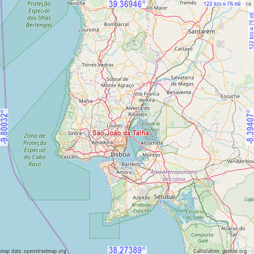
São João da Talha GPS coordinates[2]
38° 49' 25.608" North, 9° 5' 49.884" West
| Map corner | latitude | longitude |
|---|---|---|
| Upper-left | 39.36946°, | -9.80032° |
| Center: | 38.82378°, | -9.09719° |
| Lower-right: | 38.27389°, | -8.39407° |
| Map W x H: | 121.8×121.8 km | = 75.7×75.7mi |
| max Lat: | 42.11337° ⇑68% North |
| São João da Talha: | 38.82378° |
| min Lat: | ⇓32% South 32.6448° |
| min Long | São João da T | max Long |
| -31.17847° | -9.09719° | -6.27308° |
| W 22.7%⇐ | ⇒77.3% E |
Elevation
Elevation of São João da Talha is 10 m = 33 ft, and this is 167 m = 548 ft below average elevation for this country.
| Max E: |
1008 m = 3307 ft | 95% |
| Avg. | 177 m = 581 ft | |
| São João da Talha | 10 m = 33 ft | |
Min E: |
-128 m = -420 ft | 5% |
See also: Portugal elevation on elevation.city.
Geographical zone
São João da Talha is located in North temperate zone (between Tropic of Cancer and the Arctic Circle). Distance of this Northern Tropic circle is 1710.9 km =1063.1 mi to South.| Distance of | km | miles | from São João da Talha |
|---|---|---|---|
| North Pole | 5690.3 | 3535.8 | to North |
| Arctic Circle | 3084.4 | 1916.6 | to North |
| Tropic Cancer | 1710.9 | 1063.1 | to South |
| Equator | 4316.8 | 2682.3 | to South |


Nearby cities:
15 places around São João da Talha: (largest is in red/bold)
• Apelação
3.2 km =2 mi,  250°
250°
• Bobadela
1.8 km =1.1 mi,  185°
185°
• Camarate
3.5 km =2.2 mi,  230°
230°
• Charneca
6 km =3.7 mi,  221°
221°
• Loures
6.2 km =3.9 mi,  277°
277°
• Moscavide e Portela
5 km =3.1 mi, 185°
• Olivais
6 km =3.7 mi, 187°
• Prior Velho
4.1 km =2.5 mi,  210°
210°
• Póvoa de Santa Iria
5 km =3.1 mi,  34°
34°
• Póvoa de Santo Adrião
6.6 km =4.1 mi, 246°
• Sacavém
3.7 km =2.3 mi, 194°
• Santa Iria da Azóia
1.9 km =1.2 mi,  355°
355°
• Santo Antão do Tojal
4.8 km =3 mi,  309°
309°
• Unhos
2 km =1.2 mi,  256°
256°
• Vialonga
5.6 km =3.5 mi,  17°
17°
Sources, notices
• [Note1] Compared only with cities in Portugal existing in our database
• [Src1] Map data: © OpenStreetMap contributors (CC-BY-SA)
• [Src2] Other city data from geonames.org with taken over terms of usage.
• [Src3] Geographical zone / Annual Mean Temperature by Robert A. Rohde @ Wikipedia
