Moscavide e Portela geodata
Moscavide e Portela (Lisbon) is a populated place; located in Portugal in Europe/Lisbon (GMT+1) time zone. With population of 22,488 people, there are 82 cities with bigger population in this country. Compared to other cities in Portugal, 70.2% of cities are located further ↑North; 77.9% of cities are located further →East and 80.9% of cities have higher elevation than Moscavide e Portela. Note1


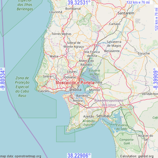
Moscavide e Portela GPS coordinates[2]
38° 46' 45.444" North, 9° 6' 7.992" West
| Map corner | latitude | longitude |
|---|---|---|
| Upper-left | 39.32531°, | -9.80534° |
| Center: | 38.77929°, | -9.10222° |
| Lower-right: | 38.22906°, | -8.39909° |
| Map W x H: | 121.9×121.9 km | = 75.7×75.7mi |
| max Lat: | 42.11337° ⇑70.2% North |
| Moscavide e Portela: | 38.77929° |
| min Lat: | ⇓29.8% South 32.6448° |
| min Long | Moscavide e Por | max Long |
| -31.17847° | -9.10222° | -6.27308° |
| W 22.1%⇐ | ⇒77.9% E |
Elevation
Elevation of Moscavide e Portela is 32 m = 105 ft, and this is 145 m = 476 ft below average elevation for this country.
| Max E: |
1008 m = 3307 ft | 80.9% |
| Avg. | 177 m = 581 ft | |
| Moscavide e Portela | 32 m = 105 ft | |
Min E: |
-128 m = -420 ft | 19.1% |
See also: Portugal elevation on elevation.city.
Geographical zone
Moscavide e Portela is located in North temperate zone (between Tropic of Cancer and the Arctic Circle). Distance of this Northern Tropic circle is 1705.9 km =1060 mi to South.| Distance of | km | miles | from Moscavide e Portela |
|---|---|---|---|
| North Pole | 5695.2 | 3538.8 | to North |
| Arctic Circle | 3089.3 | 1919.6 | to North |
| Tropic Cancer | 1705.9 | 1060 | to South |
| Equator | 4311.9 | 2679.3 | to South |


Nearby cities:
15 places around Moscavide e Portela: (largest is in red/bold)
• Alvalade
4.6 km =2.9 mi,  231°
231°
• Apelação
4.6 km =2.9 mi,  325°
325°
• Beato António
5.1 km =3.2 mi,  181°
181°
• Bobadela
3.2 km =2 mi,  4°
4°
• Camarate
3.5 km =2.2 mi,  320°
320°
• Charneca
3.6 km =2.2 mi,  277°
277°
• Odivelas
7.2 km =4.5 mi, 281°
• Olivais
1.1 km =0.7 mi,  200°
200°
• Olival do Basto
5.7 km =3.5 mi, 282°
• Prior Velho
2.1 km =1.3 mi,  310°
310°
• Póvoa de Santo Adrião
6 km =3.7 mi,  292°
292°
• Sacavém
1.5 km =0.9 mi,  340°
340°
• Santa Iria da Azóia
6.9 km =4.3 mi, 2°
• São João da Talha
5 km =3.1 mi,  5°
5°
• Unhos
4.7 km =2.9 mi, 340°
Sources, notices
• [Note1] Compared only with cities in Portugal existing in our database
• [Src1] Map data: © OpenStreetMap contributors (CC-BY-SA)
• [Src2] Other city data from geonames.org with taken over terms of usage.
• [Src3] Geographical zone / Annual Mean Temperature by Robert A. Rohde @ Wikipedia
