Castro Verde geodata
Castro Verde (Beja) is a seat of a second-order administrative division; located in Portugal in Europe/Lisbon (GMT+1) time zone. With population of 4,857 people, there are 441 cities with bigger population in this country. Compared to other cities in Portugal, 88.6% of cities are located further ↑North; 77% of cities are located further ←West and 76% of cities have lower elevation than Castro Verde. Note1


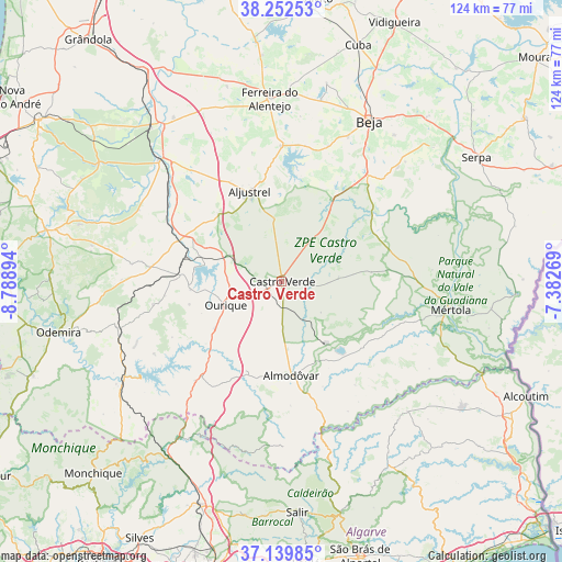
Castro Verde GPS coordinates[2]
37° 41' 53.808" North, 8° 5' 8.916" West
| Map corner | latitude | longitude |
|---|---|---|
| Upper-left | 38.25253°, | -8.78894° |
| Center: | 37.69828°, | -8.08581° |
| Lower-right: | 37.13985°, | -7.38269° |
| Map W x H: | 123.7×123.7 km | = 76.9×76.9mi |
| max Lat: | 42.11337° ⇑88.6% North |
| Castro Verde: | 37.69828° |
| min Lat: | ⇓11.4% South 32.6448° |
| min Long | Castro Verde | max Long |
| -31.17847° | -8.08581° | -6.27308° |
| W 77%⇐ | ⇒23% E |
Elevation
Elevation of Castro Verde is 242 m = 794 ft, and this is 65 m = 213 ft above average elevation for this country.
| Max E: |
1008 m = 3307 ft | 24% |
| Castro Verde | 242 m 794 ft | |
| Avg. | 177 m = 581 ft | |
Min E: |
-128 m = -420 ft | 76% |
See also: Portugal elevation on elevation.city.
Geographical zone
Castro Verde is located in North temperate zone (between Tropic of Cancer and the Arctic Circle). Distance of this Northern Tropic circle is 1585.7 km =985.3 mi to South.| Distance of | km | miles | from Castro Verde |
|---|---|---|---|
| North Pole | 5815.4 | 3613.5 | to North |
| Arctic Circle | 3209.5 | 1994.3 | to North |
| Tropic Cancer | 1585.7 | 985.3 | to South |
| Equator | 4191.7 | 2604.6 | to South |


Nearby cities:
15 places around Castro Verde: (largest is in red/bold)
• Aljustrel
21.1 km =13.1 mi,  340°
340°
• Almodôvar
20.7 km =12.9 mi,  173°
173°
• Beja
40.3 km =25 mi,  29°
29°
• Beringel
40.8 km =25.4 mi,  12°
12°
• Cabeça Gorda
35.9 km =22.3 mi,  45°
45°
• Ferreira do Alentejo
39.4 km =24.5 mi, 6°
• Mombeja
36.5 km =22.7 mi, 6°
• Mértola
37.9 km =23.5 mi,  99°
99°
• Neves
43.3 km =26.9 mi, 33°
• Ourique
13.3 km =8.3 mi,  248°
248°
• Penedo Gordo
35.2 km =21.9 mi, 25°
• Salvada
38.2 km =23.7 mi, 45°
• Santa Clara de Louredo
35.7 km =22.2 mi, 31°
• Santa Vitória
30.5 km =19 mi, 9°
• São Brissos
43.3 km =26.9 mi,  16°
16°
Sources, notices
• [Note1] Compared only with cities in Portugal existing in our database
• [Src1] Map data: © OpenStreetMap contributors (CC-BY-SA)
• [Src2] Other city data from geonames.org with taken over terms of usage.
• [Src3] Geographical zone / Annual Mean Temperature by Robert A. Rohde @ Wikipedia
