Caldas da Rainha geodata
Caldas da Rainha (Leiria) is a seat of a second-order administrative division; located in Portugal in Europe/Lisbon (GMT+1) time zone. With population of 27,378 people, there are 63 cities with bigger population in this country. Compared to other cities in Portugal, 56.2% of cities are located further ↑North; 79.9% of cities are located further →East and 65.6% of cities have higher elevation than Caldas da Rainha. Note1
Administrative division(s):
- Level 1: Leiria
- Level 2: Caldas da Rainha
- Level 3: Caldas da Rainha (Nossa Senhora do Pópulo)


Caldas da Rainha GPS coordinates[2]
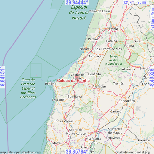
39° 24' 11.736" North, 9° 8' 18.204" West
| Map corner | latitude | longitude |
|---|---|---|
| Upper-left | 39.94444°, | -9.84151° |
| Center: | 39.40326°, | -9.13839° |
| Lower-right: | 38.85784°, | -8.43526° |
| Map W x H: | 120.8×120.8 km | = 75.1×75.1mi |
| max Lat: | 42.11337° ⇑56.2% North |
| Caldas da Rainha: | 39.40326° |
| min Lat: | ⇓43.8% South 32.6448° |
| min Long | Caldas da Rainh | max Long |
| -31.17847° | -9.13839° | -6.27308° |
| W 20.1%⇐ | ⇒79.9% E |
Elevation
Elevation of Caldas da Rainha is 60 m = 197 ft, and this is 117 m = 384 ft below average elevation for this country.
| Max E: |
1008 m = 3307 ft | 65.6% |
| Avg. | 177 m = 581 ft | |
| Caldas da Rainha | 60 m = 197 ft | |
Min E: |
-128 m = -420 ft | 34.4% |
See also: Portugal elevation on elevation.city.
Geographical zone
Caldas da Rainha is located in North temperate zone (between Tropic of Cancer and the Arctic Circle). Distance of this Northern Tropic circle is 1775.3 km =1103.1 mi to South.| Distance of | km | miles | from Caldas da Rainha |
|---|---|---|---|
| North Pole | 5625.8 | 3495.7 | to North |
| Arctic Circle | 3019.9 | 1876.5 | to North |
| Tropic Cancer | 1775.3 | 1103.1 | to South |
| Equator | 4381.2 | 2722.4 | to South |


Nearby cities:
15 places around Caldas da Rainha: (largest is in red/bold)
• A dos Francos
11.9 km =7.4 mi,  138°
138°
• Alfeizerão
11.1 km =6.9 mi,  15°
15°
• Alvorninha
9 km =5.6 mi,  104°
104°
• Benedita
14.7 km =9.1 mi,  80°
80°
• Bombarral
15.2 km =9.4 mi,  186°
186°
• Foz do Arelho
7.5 km =4.7 mi,  299°
299°
• Nadadouro
4.9 km =3 mi,  291°
291°
• Salir de Matos
4.9 km =3 mi,  49°
49°
• Salir do Porto
10.3 km =6.4 mi,  351°
351°
• Serra de El-Rei
13.6 km =8.5 mi,  235°
235°
• Serra do Bouro
6.7 km =4.2 mi,  329°
329°
• São Martinho do Porto
12.4 km =7.7 mi,  2°
2°
• Turquel
15.4 km =9.6 mi,  63°
63°
• Vidais
8.6 km =5.3 mi,  116°
116°
• Óbidos
5 km =3.1 mi,  198°
198°
Sources, notices
• [Note1] Compared only with cities in Portugal existing in our database
• [Src1] Map data: © OpenStreetMap contributors (CC-BY-SA)
• [Src2] Other city data from geonames.org with taken over terms of usage.
• [Src3] Geographical zone / Annual Mean Temperature by Robert A. Rohde @ Wikipedia
