Benavente geodata
Benavente (Santarém) is a seat of a second-order administrative division; located in Portugal in Europe/Lisbon (GMT+1) time zone. With population of 8,932 people, there are 248 cities with bigger population in this country. Compared to other cities in Portugal, 64.8% of cities are located further ↑North; 68.9% of cities are located further →East and 92.5% of cities have higher elevation than Benavente. Note1


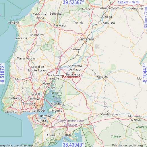
Benavente GPS coordinates[2]
38° 58' 45.084" North, 8° 48' 27.324" West
| Map corner | latitude | longitude |
|---|---|---|
| Upper-left | 39.52367°, | -9.51072° |
| Center: | 38.97919°, | -8.80759° |
| Lower-right: | 38.43049°, | -8.10447° |
| Map W x H: | 121.6×121.5 km | = 75.6×75.5mi |
| max Lat: | 42.11337° ⇑64.8% North |
| Benavente: | 38.97919° |
| min Lat: | ⇓35.2% South 32.6448° |
| min Long | Benavente | max Long |
| -31.17847° | -8.80759° | -6.27308° |
| W 31.1%⇐ | ⇒68.9% E |
Elevation
Elevation of Benavente is 13 m = 43 ft, and this is 164 m = 538 ft below average elevation for this country.
| Max E: |
1008 m = 3307 ft | 92.5% |
| Avg. | 177 m = 581 ft | |
| Benavente | 13 m = 43 ft | |
Min E: |
-128 m = -420 ft | 7.5% |
See also: Portugal elevation on elevation.city.
Geographical zone
Benavente is located in North temperate zone (between Tropic of Cancer and the Arctic Circle). Distance of this Northern Tropic circle is 1728.2 km =1073.9 mi to South.| Distance of | km | miles | from Benavente |
|---|---|---|---|
| North Pole | 5673 | 3525 | to North |
| Arctic Circle | 3067.1 | 1905.8 | to North |
| Tropic Cancer | 1728.2 | 1073.9 | to South |
| Equator | 4334.1 | 2693.1 | to South |


Nearby cities:
15 places around Benavente: (largest is in red/bold)
• Alenquer
19.3 km =12 mi,  295°
295°
• Alhandra
18.3 km =11.4 mi,  251°
251°
• Aveiras de Cima
19.3 km =12 mi,  335°
335°
• Azambuja
11.4 km =7.1 mi,  332°
332°
• Cadafais
17.2 km =10.7 mi,  279°
279°
• Carregado
15.4 km =9.6 mi,  288°
288°
• Cartaxo
20.2 km =12.6 mi,  4°
4°
• Castanheira do Ribatejo
14.4 km =8.9 mi, 276°
• Marinhais
11.8 km =7.3 mi,  50°
50°
• Poceirão
16.5 km =10.3 mi,  175°
175°
• Pontével
19.1 km =11.9 mi,  351°
351°
• Salvaterra de Magos
5.5 km =3.4 mi,  12°
12°
• Samora Correia
7.3 km =4.5 mi,  229°
229°
• São João dos Montes
18.8 km =11.7 mi,  256°
256°
• Vila Franca de Xira
16 km =9.9 mi, 260°
Sources, notices
• [Note1] Compared only with cities in Portugal existing in our database
• [Src1] Map data: © OpenStreetMap contributors (CC-BY-SA)
• [Src2] Other city data from geonames.org with taken over terms of usage.
• [Src3] Geographical zone / Annual Mean Temperature by Robert A. Rohde @ Wikipedia
