Itá geodata
Itá (Central) is a populated place; located in Paraguay in America/Asuncion (GMT-4) time zone. With population of 18,459 people, there are 23 cities with bigger population in this country. Compared to other cities in Paraguay, 51.2% of cities are located further ↑North; 82.1% of cities are located further →East and 55.6% of cities have lower elevation than Itá. Note1


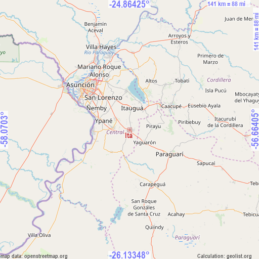
Itá GPS coordinates[2]
25° 30' 1.944" South, 57° 22' 1.812" West
| Map corner | latitude | longitude |
|---|---|---|
| Upper-left | -24.86425°, | -58.0703° |
| Center: | -25.50054°, | -57.36717° |
| Lower-right: | -26.13348°, | -56.66405° |
| Map W x H: | 141.1×141.1 km | = 87.7×87.7mi |
| max Lat: | -19.91667° ⇑51.2% North |
| Itá: | -25.50054° |
| min Lat: | ⇓48.8% South -27.38662° |
| min Long | Itá | max Long |
| -60.78333° | -57.36717° | -54.30694° |
| W 17.9%⇐ | ⇒82.1% E |
Elevation
Elevation of Itá is 147 m = 482 ft, and this is 22.7 m = 74 ft below average elevation for this country.
| Max E: |
658 m = 2159 ft | 44.4% |
| Avg. | 169.7 m = 557 ft | |
| Itá | 147 m = 482 ft | |
Min E: |
46 m = 151 ft | 55.6% |
See also: Paraguay elevation on elevation.city.
Geographical zone
Itá is located in South temperate zone (between Tropic of Capricorn and the Antarctic Circle). Distance of this Southern Tropic circle is 229.5 km =142.6 mi to North.| Distance of | km | miles | from Itá |
|---|---|---|---|
| Equator | 2835.4 | 1761.8 | to North |
| Tropic Capricorn | 229.5 | 142.6 | to North |
| Antarctic Circle | 4565.8 | 2837.1 | to South |
| South Pole | 7171.7 | 4456.3 | to South |


Nearby cities:
15 places around Itá: (largest is in red/bold)
• Areguá
21 km =13 mi,  355°
355°
• Caacupé
25.9 km =16.1 mi,  60°
60°
• Capiatá
18 km =11.2 mi,  334°
334°
• Fernando de la Mora
23.8 km =14.8 mi,  319°
319°
• Guarambaré
8.9 km =5.5 mi,  276°
276°
• Itauguá
12.1 km =7.5 mi,  6°
6°
• Nemby
20.6 km =12.8 mi,  304°
304°
• Nueva Italia
15.7 km =9.8 mi,  218°
218°
• Paraguarí
25.8 km =16 mi,  121°
121°
• Pirayú
13.4 km =8.3 mi,  82°
82°
• San Antonio
20.1 km =12.5 mi, 295°
• San Bernardino
22.3 km =13.9 mi,  18°
18°
• San Lorenzo
22.9 km =14.2 mi, 321°
• Yaguarón
10.8 km =6.7 mi,  128°
128°
• Ypacarai
13 km =8.1 mi,  37°
37°
Sources, notices
• [Note1] Compared only with cities in Paraguay existing in our database
• [Src1] Map data: © OpenStreetMap contributors (CC-BY-SA)
• [Src2] Other city data from geonames.org with taken over terms of usage.
• [Src3] Geographical zone / Annual Mean Temperature by Robert A. Rohde @ Wikipedia
