Dragoslavele geodata
Dragoslavele (Arges) is a populated place; located in Romania in Europe/Bucharest (GMT+3) time zone. With population of 2,480 people, there are 2179 cities with bigger population in this country. Compared to other cities in Romania, 57.9% of cities are located further ↑North; 50.4% of cities are located further →East and 96.2% of cities have lower elevation than Dragoslavele. Note1


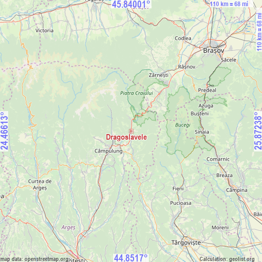
Dragoslavele GPS coordinates[2]
45° 20' 52.836" North, 25° 10' 9.3" East
| Map corner | latitude | longitude |
|---|---|---|
| Upper-left | 45.84001°, | 24.46613° |
| Center: | 45.34801°, | 25.16925° |
| Lower-right: | 44.8517°, | 25.87238° |
| Map W x H: | 109.9×109.9 km | = 68.3×68.3mi |
| max Lat: | 48.23793° ⇑57.9% North |
| Dragoslavele: | 45.34801° |
| min Lat: | ⇓42.1% South 43.65638° |
| min Long | Dragoslavele | max Long |
| 20.31667° | 25.16925° | 29.65403° |
| W 49.6%⇐ | ⇒50.4% E |
Elevation
Elevation of Dragoslavele is 675 m = 2215 ft, and this is 420.1 m = 1378 ft above average elevation for this country.
| Max E: |
1278 m = 4193 ft | 3.8% |
| Dragoslavele | 675 m 2215 ft | |
| Avg. | 254.9 m = 836 ft | |
Min E: |
-2 m = -7 ft | 96.2% |
See also: Romania elevation on elevation.city.
Geographical zone
Dragoslavele is located in North temperate zone (between Tropic of Cancer and the Arctic Circle). Distance of this North polar circle is 2358.9 km =1465.8 mi to North.| Distance of | km | miles | from Dragoslavele |
|---|---|---|---|
| North Pole | 4964.8 | 3085 | to North |
| Arctic Circle | 2358.9 | 1465.8 | to North |
| Tropic Cancer | 2436.3 | 1513.8 | to South |
| Equator | 5042.2 | 3133.1 | to South |


Nearby cities:
15 places around Dragoslavele: (largest is in red/bold)
• Bughea de Sus
12 km =7.5 mi,  242°
242°
• Bădeni
11.6 km =7.2 mi,  175°
175°
• Cotenești
12.7 km =7.9 mi,  174°
174°
• Dâmbovicioara
12.4 km =7.7 mi,  23°
23°
• Gura Pravăț
4.1 km =2.5 mi,  230°
230°
• Lereşti
8.2 km =5.1 mi,  258°
258°
• Nămăești
6.5 km =4 mi,  222°
222°
• Piatra
8 km =5 mi,  188°
188°
• Rucăr
5.8 km =3.6 mi,  358°
358°
• Slobozia
8.2 km =5.1 mi, 173°
• Stoeneşti
10.9 km =6.8 mi, 181°
• Valea Bădenilor
9.7 km =6 mi, 168°
• Valea Caselor
0.3 km =0.2 mi,  317°
317°
• Valea Mare Pravăț
8.7 km =5.4 mi, 223°
• Voinești
9.3 km =5.8 mi, 234°
Sources, notices
• [Note1] Compared only with cities in Romania existing in our database
• [Src1] Map data: © OpenStreetMap contributors (CC-BY-SA)
• [Src2] Other city data from geonames.org with taken over terms of usage.
• [Src3] Geographical zone / Annual Mean Temperature by Robert A. Rohde @ Wikipedia
