Zigoneni geodata
Zigoneni (Arges) is a populated place; located in Romania in Europe/Bucharest (GMT+3) time zone. With population of 926 people, there are 4532 cities with bigger population in this country. Compared to other cities in Romania, 65.8% of cities are located further ↑North; 57.5% of cities are located further →East and 81.9% of cities have lower elevation than Zigoneni. Note1


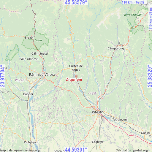
Zigoneni GPS coordinates[2]
45° 5' 29.616" North, 24° 40' 48.576" East
| Map corner | latitude | longitude |
|---|---|---|
| Upper-left | 45.58579°, | 23.97704° |
| Center: | 45.09156°, | 24.68016° |
| Lower-right: | 44.59301°, | 25.38329° |
| Map W x H: | 110.4×110.4 km | = 68.6×68.6mi |
| max Lat: | 48.23793° ⇑65.8% North |
| Zigoneni: | 45.09156° |
| min Lat: | ⇓34.2% South 43.65638° |
| min Long | Zigoneni | max Long |
| 20.31667° | 24.68016° | 29.65403° |
| W 42.5%⇐ | ⇒57.5% E |
Elevation
Elevation of Zigoneni is 411 m = 1348 ft, and this is 156.1 m = 512 ft above average elevation for this country.
| Max E: |
1278 m = 4193 ft | 18.1% |
| Zigoneni | 411 m 1348 ft | |
| Avg. | 254.9 m = 836 ft | |
Min E: |
-2 m = -7 ft | 81.9% |
See also: Romania elevation on elevation.city.
Geographical zone
Zigoneni is located in North temperate zone (between Tropic of Cancer and the Arctic Circle). Distance of this North polar circle is 2387.5 km =1483.5 mi to North.| Distance of | km | miles | from Zigoneni |
|---|---|---|---|
| North Pole | 4993.4 | 3102.8 | to North |
| Arctic Circle | 2387.5 | 1483.5 | to North |
| Tropic Cancer | 2407.8 | 1496.1 | to South |
| Equator | 5013.7 | 3115.4 | to South |


Nearby cities:
15 places around Zigoneni: (largest is in red/bold)
• Bunești
10.1 km =6.3 mi,  145°
145°
• Băiculeşti
3.2 km =2 mi, 150°
• Crâmpotani
8.5 km =5.3 mi,  169°
169°
• Curtea de Argeş
4.8 km =3 mi,  354°
354°
• Mălureni
9.5 km =5.9 mi,  84°
84°
• Mănicești
8.2 km =5.1 mi,  160°
160°
• Noapteș
2.5 km =1.6 mi,  300°
300°
• Stroești
9.9 km =6.2 mi,  64°
64°
• Tigveni
8.9 km =5.5 mi, 301°
• Toplița
4.1 km =2.5 mi,  92°
92°
• Tutana
5.9 km =3.7 mi,  202°
202°
• Valea Brazilor
4.3 km =2.7 mi,  178°
178°
• Valea Danului
10.5 km =6.5 mi, 346°
• Valea Iaşului
10.6 km =6.6 mi,  15°
15°
• Valea lui Enache
2.9 km =1.8 mi,  250°
250°
Sources, notices
• [Note1] Compared only with cities in Romania existing in our database
• [Src1] Map data: © OpenStreetMap contributors (CC-BY-SA)
• [Src2] Other city data from geonames.org with taken over terms of usage.
• [Src3] Geographical zone / Annual Mean Temperature by Robert A. Rohde @ Wikipedia
