Viișoara geodata
Viișoara (Dolj) is a populated place; located in Romania in Europe/Bucharest (GMT+3) time zone. With population of 521 people, there are 6851 cities with bigger population in this country. Compared to other cities in Romania, 92.7% of cities are located further ↑North; 67.5% of cities are located further →East and 73.3% of cities have higher elevation than Viișoara. Note1


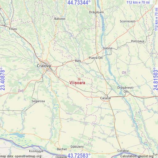
Viișoara GPS coordinates[2]
44° 13' 54.444" North, 24° 6' 42.84" East
| Map corner | latitude | longitude |
|---|---|---|
| Upper-left | 44.73344°, | 23.40878° |
| Center: | 44.23179°, | 24.1119° |
| Lower-right: | 43.72583°, | 24.81503° |
| Map W x H: | 112×112 km | = 69.6×69.6mi |
| max Lat: | 48.23793° ⇑92.7% North |
| Viișoara: | 44.23179° |
| min Lat: | ⇓7.3% South 43.65638° |
| min Long | Viișoara | max Long |
| 20.31667° | 24.1119° | 29.65403° |
| W 32.5%⇐ | ⇒67.5% E |
Elevation
Elevation of Viișoara is 116 m = 381 ft, and this is 138.9 m = 456 ft below average elevation for this country.
| Max E: |
1278 m = 4193 ft | 73.3% |
| Avg. | 254.9 m = 836 ft | |
| Viișoara | 116 m = 381 ft | |
Min E: |
-2 m = -7 ft | 26.7% |
See also: Romania elevation on elevation.city.
Geographical zone
Viișoara is located in North temperate zone (between Tropic of Cancer and the Arctic Circle). Distance of this Northern Tropic circle is 2312.2 km =1436.7 mi to South.| Distance of | km | miles | from Viișoara |
|---|---|---|---|
| North Pole | 5088.9 | 3162.1 | to North |
| Arctic Circle | 2483.1 | 1542.9 | to North |
| Tropic Cancer | 2312.2 | 1436.7 | to South |
| Equator | 4918.1 | 3056 | to South |


Nearby cities:
15 places around Viișoara: (largest is in red/bold)
• Braneț
11.7 km =7.3 mi,  26°
26°
• Bârza
11 km =6.8 mi,  12°
12°
• Ciocănești
9 km =5.6 mi,  153°
153°
• Dobrun
9.2 km =5.7 mi,  65°
65°
• Drăgoteşti
2.2 km =1.4 mi,  334°
334°
• Golfin
9.8 km =6.1 mi,  312°
312°
• Leu
10.4 km =6.5 mi,  238°
238°
• Mărgăritești
7.9 km =4.9 mi,  21°
21°
• Olari
11.4 km =7.1 mi,  42°
42°
• Pârşcoveni
12.3 km =7.6 mi,  51°
51°
• Racovița
9.3 km =5.8 mi,  4°
4°
• Radomir
13.1 km =8.1 mi,  159°
159°
• Teslui
4.5 km =2.8 mi,  130°
130°
• Voineasa
6 km =3.7 mi, 16°
• Zănoaga
8.6 km =5.3 mi,  187°
187°
Sources, notices
• [Note1] Compared only with cities in Romania existing in our database
• [Src1] Map data: © OpenStreetMap contributors (CC-BY-SA)
• [Src2] Other city data from geonames.org with taken over terms of usage.
• [Src3] Geographical zone / Annual Mean Temperature by Robert A. Rohde @ Wikipedia
