Viişoara geodata
Viişoara (Mureş) is a seat of a second-order administrative division; located in Romania in Europe/Bucharest (GMT+3) time zone. With population of 1,635 people, there are 2997 cities with bigger population in this country. Compared to other cities in Romania, 61.6% of cities are located further ↓South; 58.9% of cities are located further →East and 84.9% of cities have lower elevation than Viişoara. Note1


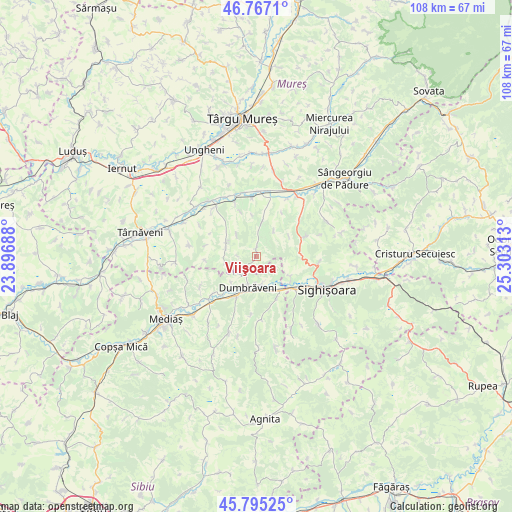
Viişoara GPS coordinates[2]
46° 16' 59.988" North, 24° 36' 0" East
| Map corner | latitude | longitude |
|---|---|---|
| Upper-left | 46.7671°, | 23.89688° |
| Center: | 46.28333°, | 24.6° |
| Lower-right: | 45.79525°, | 25.30313° |
| Map W x H: | 108.1×108.1 km | = 67.2×67.2mi |
| max Lat: | 48.23793° ⇑38.4% North |
| Viişoara: | 46.28333° |
| min Lat: | ⇓61.6% South 43.65638° |
| min Long | Viişoara | max Long |
| 20.31667° | 24.6° | 29.65403° |
| W 41.1%⇐ | ⇒58.9% E |
Elevation
Elevation of Viişoara is 445 m = 1460 ft, and this is 190.1 m = 624 ft above average elevation for this country.
| Max E: |
1278 m = 4193 ft | 15.1% |
| Viişoara | 445 m 1460 ft | |
| Avg. | 254.9 m = 836 ft | |
Min E: |
-2 m = -7 ft | 84.9% |
See also: Romania elevation on elevation.city.
Geographical zone
Viişoara is located in North temperate zone (between Tropic of Cancer and the Arctic Circle). Distance of this North polar circle is 2255 km =1401.2 mi to North.| Distance of | km | miles | from Viişoara |
|---|---|---|---|
| North Pole | 4860.8 | 3020.4 | to North |
| Arctic Circle | 2255 | 1401.2 | to North |
| Tropic Cancer | 2540.3 | 1578.5 | to South |
| Equator | 5146.2 | 3197.7 | to South |


Nearby cities:
15 places around Viişoara: (largest is in red/bold)
• Alma
12 km =7.5 mi,  229°
229°
• Daneş
10.7 km =6.6 mi,  133°
133°
• Dumbrăveni
6.1 km =3.8 mi,  204°
204°
• Gogan
6.8 km =4.2 mi,  290°
290°
• Hoghilag
5.7 km =3.5 mi,  167°
167°
• Laslea
8.3 km =5.2 mi,  152°
152°
• Nadeş
10.9 km =6.8 mi,  70°
70°
• Seleuș
8.5 km =5.3 mi,  121°
121°
• Senereuș
6.9 km =4.3 mi,  34°
34°
• Suplac
12.8 km =8 mi,  330°
330°
• Sântioana
3.7 km =2.3 mi,  270°
270°
• Valchid
12.7 km =7.9 mi,  185°
185°
• Zagăr
7.5 km =4.7 mi,  9°
9°
• Șaroș pe Târnave
10 km =6.2 mi, 202°
• Țigmandru
12.1 km =7.5 mi,  48°
48°
Sources, notices
• [Note1] Compared only with cities in Romania existing in our database
• [Src1] Map data: © OpenStreetMap contributors (CC-BY-SA)
• [Src2] Other city data from geonames.org with taken over terms of usage.
• [Src3] Geographical zone / Annual Mean Temperature by Robert A. Rohde @ Wikipedia
