Senereuș geodata
Senereuș (Mureş) is a populated place; located in Romania in Europe/Bucharest (GMT+3) time zone. With population of 680 people, there are 5689 cities with bigger population in this country. Compared to other cities in Romania, 63.1% of cities are located further ↓South; 58% of cities are located further →East and 79% of cities have lower elevation than Senereuș. Note1


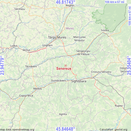
Senereuș GPS coordinates[2]
46° 20' 2.796" North, 24° 39' 3.276" East
| Map corner | latitude | longitude |
|---|---|---|
| Upper-left | 46.81743°, | 23.94779° |
| Center: | 46.33411°, | 24.65091° |
| Lower-right: | 45.84648°, | 25.35404° |
| Map W x H: | 108×108 km | = 67.1×67.1mi |
| max Lat: | 48.23793° ⇑36.9% North |
| Senereuș: | 46.33411° |
| min Lat: | ⇓63.1% South 43.65638° |
| min Long | Senereuș | max Long |
| 20.31667° | 24.65091° | 29.65403° |
| W 42%⇐ | ⇒58% E |
Elevation
Elevation of Senereuș is 384 m = 1260 ft, and this is 129.1 m = 424 ft above average elevation for this country.
| Max E: |
1278 m = 4193 ft | 21% |
| Senereuș | 384 m 1260 ft | |
| Avg. | 254.9 m = 836 ft | |
Min E: |
-2 m = -7 ft | 79% |
See also: Romania elevation on elevation.city.
Geographical zone
Senereuș is located in North temperate zone (between Tropic of Cancer and the Arctic Circle). Distance of this North polar circle is 2249.3 km =1397.6 mi to North.| Distance of | km | miles | from Senereuș |
|---|---|---|---|
| North Pole | 4855.2 | 3016.9 | to North |
| Arctic Circle | 2249.3 | 1397.6 | to North |
| Tropic Cancer | 2546 | 1582 | to South |
| Equator | 5151.9 | 3201.2 | to South |


Nearby cities:
15 places around Senereuș: (largest is in red/bold)
• Agrișteu
7 km =4.3 mi,  21°
21°
• Bălăuşeri
7.7 km =4.8 mi, 18°
• Chendu
8.8 km =5.5 mi,  42°
42°
• Coroisânmartin
8.3 km =5.2 mi,  331°
331°
• Călimănești
10.9 km =6.8 mi, 35°
• Dumitreni
11.1 km =6.9 mi,  48°
48°
• Gogan
10.8 km =6.7 mi,  252°
252°
• Nadeş
6.6 km =4.1 mi,  107°
107°
• Odrihei
10.1 km =6.3 mi,  320°
320°
• Seleuș
10.7 km =6.6 mi,  161°
161°
• Sântioana
9.5 km =5.9 mi,  233°
233°
• Veţca
10.3 km =6.4 mi,  80°
80°
• Viişoara
6.9 km =4.3 mi,  214°
214°
• Zagăr
3.2 km =2 mi,  303°
303°
• Țigmandru
5.6 km =3.5 mi,  65°
65°
Sources, notices
• [Note1] Compared only with cities in Romania existing in our database
• [Src1] Map data: © OpenStreetMap contributors (CC-BY-SA)
• [Src2] Other city data from geonames.org with taken over terms of usage.
• [Src3] Geographical zone / Annual Mean Temperature by Robert A. Rohde @ Wikipedia
