Vălişoara geodata
Vălişoara (Hunedoara) is a seat of a second-order administrative division; located in Romania in Europe/Bucharest (GMT+3) time zone. With population of 1,369 people, there are 3398 cities with bigger population in this country. Compared to other cities in Romania, 56% of cities are located further ↓South; 86.6% of cities are located further →East and 79% of cities have lower elevation than Vălişoara. Note1


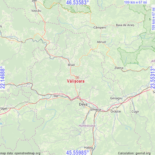
Vălişoara GPS coordinates[2]
46° 3' 0" North, 22° 51' 0" East
| Map corner | latitude | longitude |
|---|---|---|
| Upper-left | 46.53583°, | 22.14688° |
| Center: | 46.05°, | 22.85° |
| Lower-right: | 45.55985°, | 23.55313° |
| Map W x H: | 108.5×108.5 km | = 67.4×67.4mi |
| max Lat: | 48.23793° ⇑44% North |
| Vălişoara: | 46.05° |
| min Lat: | ⇓56% South 43.65638° |
| min Long | Vălişoara | max Long |
| 20.31667° | 22.85° | 29.65403° |
| W 13.4%⇐ | ⇒86.6% E |
Elevation
Elevation of Vălişoara is 384 m = 1260 ft, and this is 129.1 m = 424 ft above average elevation for this country.
| Max E: |
1278 m = 4193 ft | 21% |
| Vălişoara | 384 m 1260 ft | |
| Avg. | 254.9 m = 836 ft | |
Min E: |
-2 m = -7 ft | 79% |
See also: Romania elevation on elevation.city.
Geographical zone
Vălişoara is located in North temperate zone (between Tropic of Cancer and the Arctic Circle). Distance of this North polar circle is 2280.9 km =1417.3 mi to North.| Distance of | km | miles | from Vălişoara |
|---|---|---|---|
| North Pole | 4886.8 | 3036.5 | to North |
| Arctic Circle | 2280.9 | 1417.3 | to North |
| Tropic Cancer | 2514.4 | 1562.4 | to South |
| Equator | 5120.3 | 3181.6 | to South |


Nearby cities:
15 places around Vălişoara: (largest is in red/bold)
• Barza
7.8 km =4.8 mi,  3°
3°
• Brad
10.6 km =6.6 mi,  330°
330°
• Bucureşci
10 km =6.2 mi,  22°
22°
• Băiţa
4.3 km =2.7 mi,  115°
115°
• Crişcior
7.5 km =4.7 mi,  9°
9°
• Hondol
12.7 km =7.9 mi, 123°
• Hărțăgani
5.5 km =3.4 mi,  89°
89°
• Luncoiu de Jos
8.5 km =5.3 mi,  310°
310°
• Luncoiu de Sus
4 km =2.5 mi,  315°
315°
• Mesteacăn
12.4 km =7.7 mi, 327°
• Ormindea
0.9 km =0.6 mi,  65°
65°
• Valea Bradului
11.4 km =7.1 mi,  351°
351°
• Zdrapți
11.9 km =7.4 mi, 7°
• Șesuri
7.8 km =4.8 mi,  48°
48°
• Țărățel
8.4 km =5.2 mi,  343°
343°
Sources, notices
• [Note1] Compared only with cities in Romania existing in our database
• [Src1] Map data: © OpenStreetMap contributors (CC-BY-SA)
• [Src2] Other city data from geonames.org with taken over terms of usage.
• [Src3] Geographical zone / Annual Mean Temperature by Robert A. Rohde @ Wikipedia
