Tămaia geodata
Tămaia (Maramureş) is a populated place; located in Romania in Europe/Bucharest (GMT+3) time zone. With population of 1,000 people, there are 4293 cities with bigger population in this country. Compared to other cities in Romania, 92.9% of cities are located further ↓South; 79% of cities are located further →East and 63% of cities have higher elevation than Tămaia. Note1


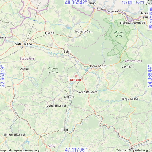
Tămaia GPS coordinates[2]
47° 35' 36.204" North, 23° 21' 58.716" East
| Map corner | latitude | longitude |
|---|---|---|
| Upper-left | 48.06542°, | 22.66319° |
| Center: | 47.59339°, | 23.36631° |
| Lower-right: | 47.11706°, | 24.06944° |
| Map W x H: | 105.4×105.4 km | = 65.5×65.5mi |
| max Lat: | 48.23793° ⇑7.1% North |
| Tămaia: | 47.59339° |
| min Lat: | ⇓92.9% South 43.65638° |
| min Long | Tămaia | max Long |
| 20.31667° | 23.36631° | 29.65403° |
| W 21%⇐ | ⇒79% E |
Elevation
Elevation of Tămaia is 155 m = 509 ft, and this is 99.9 m = 328 ft below average elevation for this country.
| Max E: |
1278 m = 4193 ft | 63% |
| Avg. | 254.9 m = 836 ft | |
| Tămaia | 155 m = 509 ft | |
Min E: |
-2 m = -7 ft | 37% |
See also: Romania elevation on elevation.city.
Geographical zone
Tămaia is located in North temperate zone (between Tropic of Cancer and the Arctic Circle). Distance of this North polar circle is 2109.3 km =1310.7 mi to North.| Distance of | km | miles | from Tămaia |
|---|---|---|---|
| North Pole | 4715.2 | 2929.9 | to North |
| Arctic Circle | 2109.3 | 1310.7 | to North |
| Tropic Cancer | 2686 | 1669 | to South |
| Equator | 5291.9 | 3288.2 | to South |


Nearby cities:
15 places around Tămaia: (largest is in red/bold)
• Ardusat
6.3 km =3.9 mi,  0°
0°
• Bozânta Mare
7.7 km =4.8 mi,  47°
47°
• Buzești
1.8 km =1.1 mi,  333°
333°
• Bârsău de Jos
7.7 km =4.8 mi,  271°
271°
• Fersig
6 km =3.7 mi,  167°
167°
• Finteușu Mic
7.2 km =4.5 mi,  113°
113°
• Fărcaşa
2.7 km =1.7 mi,  245°
245°
• Gârdani
6.4 km =4 mi,  222°
222°
• Hideaga
4.1 km =2.5 mi,  93°
93°
• Lucăcești
6.4 km =4 mi,  201°
201°
• Mogoșești
2.8 km =1.7 mi,  118°
118°
• Pribilești
3.2 km =2 mi, 170°
• Satulung
5.8 km =3.6 mi, 120°
• Sârbi
1.7 km =1.1 mi, 272°
• Sălsig
8.3 km =5.2 mi, 216°
Sources, notices
• [Note1] Compared only with cities in Romania existing in our database
• [Src1] Map data: © OpenStreetMap contributors (CC-BY-SA)
• [Src2] Other city data from geonames.org with taken over terms of usage.
• [Src3] Geographical zone / Annual Mean Temperature by Robert A. Rohde @ Wikipedia
