Tăgădău geodata
Tăgădău (Arad) is a populated locality; located in Romania in Europe/Bucharest (GMT+3) time zone. With population of 525 people, there are 6818 cities with bigger population in this country. Compared to other cities in Romania, 67.3% of cities are located further ↓South; 94.5% of cities are located further →East and 66.8% of cities have higher elevation than Tăgădău. Note1


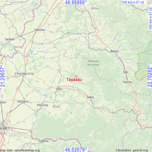
Tăgădău GPS coordinates[2]
46° 30' 24.768" North, 21° 59' 58.884" East
| Map corner | latitude | longitude |
|---|---|---|
| Upper-left | 46.98866°, | 21.29657° |
| Center: | 46.50688°, | 21.99969° |
| Lower-right: | 46.02079°, | 22.70282° |
| Map W x H: | 107.6×107.6 km | = 66.9×66.9mi |
| max Lat: | 48.23793° ⇑32.7% North |
| Tăgădău: | 46.50688° |
| min Lat: | ⇓67.3% South 43.65638° |
| min Long | Tăgădău | max Long |
| 20.31667° | 21.99969° | 29.65403° |
| W 5.5%⇐ | ⇒94.5% E |
Elevation
Elevation of Tăgădău is 140 m = 459 ft, and this is 114.9 m = 377 ft below average elevation for this country.
| Max E: |
1278 m = 4193 ft | 66.8% |
| Avg. | 254.9 m = 836 ft | |
| Tăgădău | 140 m = 459 ft | |
Min E: |
-2 m = -7 ft | 33.2% |
See also: Romania elevation on elevation.city.
Geographical zone
Tăgădău is located in North temperate zone (between Tropic of Cancer and the Arctic Circle). Distance of this North polar circle is 2230.1 km =1385.7 mi to North.| Distance of | km | miles | from Tăgădău |
|---|---|---|---|
| North Pole | 4836 | 3005 | to North |
| Arctic Circle | 2230.1 | 1385.7 | to North |
| Tropic Cancer | 2565.2 | 1593.9 | to South |
| Equator | 5171.1 | 3213.2 | to South |


Nearby cities:
15 places around Tăgădău: (largest is in red/bold)
• Aldești
12.9 km =8 mi,  165°
165°
• Archiş
4.7 km =2.9 mi,  124°
124°
• Beliu
2.9 km =1.8 mi,  205°
205°
• Bocsig
10.7 km =6.6 mi,  200°
200°
• Cermei
12.4 km =7.7 mi,  292°
292°
• Chișlaca
6 km =3.7 mi,  331°
331°
• Craiva
8.9 km =5.5 mi,  343°
343°
• Cărand
9 km =5.6 mi,  134°
134°
• Groșeni
9.1 km =5.7 mi,  96°
96°
• Hășmaș
6.4 km =4 mi, 96°
• Prunișor
13.5 km =8.4 mi,  136°
136°
• Răpsig
9.7 km =6 mi, 170°
• Seliștea
5 km =3.1 mi,  155°
155°
• Susag
13.2 km =8.2 mi, 331°
• Șomoșcheș
13.8 km =8.6 mi,  302°
302°
Sources, notices
• [Note1] Compared only with cities in Romania existing in our database
• [Src1] Map data: © OpenStreetMap contributors (CC-BY-SA)
• [Src2] Other city data from geonames.org with taken over terms of usage.
• [Src3] Geographical zone / Annual Mean Temperature by Robert A. Rohde @ Wikipedia
