Orşova geodata
Orşova (Mehedinţi) is a seat of a second-order administrative division; located in Romania in Europe/Bucharest (GMT+3) time zone. With population of 12,350 people, there are 156 cities with bigger population in this country. Compared to other cities in Romania, 79.3% of cities are located further ↑North; 90.7% of cities are located further →East and 90.7% of cities have higher elevation than Orşova. Note1


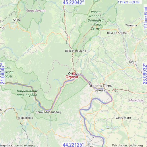
Orşova GPS coordinates[2]
44° 43' 22.764" North, 22° 23' 46.284" East
| Map corner | latitude | longitude |
|---|---|---|
| Upper-left | 45.22042°, | 21.69307° |
| Center: | 44.72299°, | 22.39619° |
| Lower-right: | 44.22125°, | 23.09932° |
| Map W x H: | 111.1×111.1 km | = 69×69mi |
| max Lat: | 48.23793° ⇑79.3% North |
| Orşova: | 44.72299° |
| min Lat: | ⇓20.7% South 43.65638° |
| min Long | Orşova | max Long |
| 20.31667° | 22.39619° | 29.65403° |
| W 9.3%⇐ | ⇒90.7% E |
Elevation
Elevation of Orşova is 55 m = 180 ft, and this is 199.9 m = 656 ft below average elevation for this country.
| Max E: |
1278 m = 4193 ft | 90.7% |
| Avg. | 254.9 m = 836 ft | |
| Orşova | 55 m = 180 ft | |
Min E: |
-2 m = -7 ft | 9.3% |
See also: Romania elevation on elevation.city.
Geographical zone
Orşova is located in North temperate zone (between Tropic of Cancer and the Arctic Circle). Distance of this Northern Tropic circle is 2366.8 km =1470.7 mi to South.| Distance of | km | miles | from Orşova |
|---|---|---|---|
| North Pole | 5034.3 | 3128.2 | to North |
| Arctic Circle | 2428.4 | 1508.9 | to North |
| Tropic Cancer | 2366.8 | 1470.7 | to South |
| Equator | 4972.7 | 3089.9 | to South |


Nearby cities:
15 places around Orşova: (largest is in red/bold)
• Brezniţa Ocol
18.6 km =11.6 mi,  109°
109°
• Bârza
9.8 km =6.1 mi,  355°
355°
• Băile Herculane
17.5 km =10.9 mi,  4°
4°
• Cireşu
15.8 km =9.8 mi,  45°
45°
• Dubova
15.6 km =9.7 mi,  220°
220°
• Dudașu Schelei
18.3 km =11.4 mi,  119°
119°
• Eşelniţa
3.8 km =2.4 mi,  225°
225°
• Godeanu
18.9 km =11.7 mi,  62°
62°
• Gura Văii
14.1 km =8.8 mi, 116°
• Iloviţa
7.1 km =4.4 mi, 58°
• Jidoștița
15.6 km =9.7 mi,  92°
92°
• Magheru
20.1 km =12.5 mi, 112°
• Mehadia
19.9 km =12.4 mi,  353°
353°
• Pecinișca
15.2 km =9.4 mi, 2°
• Topleţ
8.3 km =5.2 mi, 359°
Sources, notices
• [Note1] Compared only with cities in Romania existing in our database
• [Src1] Map data: © OpenStreetMap contributors (CC-BY-SA)
• [Src2] Other city data from geonames.org with taken over terms of usage.
• [Src3] Geographical zone / Annual Mean Temperature by Robert A. Rohde @ Wikipedia
