Suseni geodata
Suseni (Harghita) is a seat of a second-order administrative division; located in Romania in Europe/Bucharest (GMT+3) time zone. With population of 5,079 people, there are 756 cities with bigger population in this country. Compared to other cities in Romania, 70.8% of cities are located further ↓South; 55.2% of cities are located further ←West and 97.6% of cities have lower elevation than Suseni. Note1


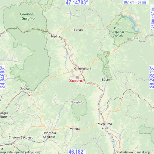
Suseni GPS coordinates[2]
46° 40' 0.012" North, 25° 33' 0" East
| Map corner | latitude | longitude |
|---|---|---|
| Upper-left | 47.14703°, | 24.84688° |
| Center: | 46.66667°, | 25.55° |
| Lower-right: | 46.182°, | 26.25313° |
| Map W x H: | 107.3×107.3 km | = 66.7×66.7mi |
| max Lat: | 48.23793° ⇑29.2% North |
| Suseni: | 46.66667° |
| min Lat: | ⇓70.8% South 43.65638° |
| min Long | Suseni | max Long |
| 20.31667° | 25.55° | 29.65403° |
| W 55.2%⇐ | ⇒44.8% E |
Elevation
Elevation of Suseni is 745 m = 2444 ft, and this is 490.1 m = 1608 ft above average elevation for this country.
| Max E: |
1278 m = 4193 ft | 2.4% |
| Suseni | 745 m 2444 ft | |
| Avg. | 254.9 m = 836 ft | |
Min E: |
-2 m = -7 ft | 97.6% |
See also: Romania elevation on elevation.city.
Geographical zone
Suseni is located in North temperate zone (between Tropic of Cancer and the Arctic Circle). Distance of this North polar circle is 2212.3 km =1374.7 mi to North.| Distance of | km | miles | from Suseni |
|---|---|---|---|
| North Pole | 4818.2 | 2993.9 | to North |
| Arctic Circle | 2212.3 | 1374.7 | to North |
| Tropic Cancer | 2582.9 | 1604.9 | to South |
| Equator | 5188.8 | 3224.2 | to South |


Nearby cities:
15 places around Suseni: (largest is in red/bold)
• Borzont
8.1 km =5 mi,  293°
293°
• Bălan
19.8 km =12.3 mi,  95°
95°
• Chileni
2.4 km =1.5 mi,  47°
47°
• Ciumani
3.1 km =1.9 mi,  306°
306°
• Cârţa
21.3 km =13.2 mi,  134°
134°
• Ditrău
16.9 km =10.5 mi,  351°
351°
• Gheorgheni
7.3 km =4.5 mi,  31°
31°
• Ineu
21.2 km =13.2 mi, 129°
• Izvoru Mureșului
11 km =6.8 mi,  113°
113°
• Joseni
5.3 km =3.3 mi, 314°
• Lăzarea
9.4 km =5.8 mi, 352°
• Remetea
15 km =9.3 mi,  329°
329°
• Sândominic
19.8 km =12.3 mi,  117°
117°
• Valea Strâmbă
4.9 km =3 mi, 50°
• Voșlăbeni
6.6 km =4.1 mi, 106°
Sources, notices
• [Note1] Compared only with cities in Romania existing in our database
• [Src1] Map data: © OpenStreetMap contributors (CC-BY-SA)
• [Src2] Other city data from geonames.org with taken over terms of usage.
• [Src3] Geographical zone / Annual Mean Temperature by Robert A. Rohde @ Wikipedia
