Șomănești geodata
Șomănești (Gorj) is a populated place; located in Romania in Europe/Bucharest (GMT+3) time zone. With population of 716 people, there are 5480 cities with bigger population in this country. Compared to other cities in Romania, 71.1% of cities are located further ↑North; 82.9% of cities are located further →East and 57.7% of cities have higher elevation than Șomănești. Note1


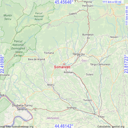
Șomănești GPS coordinates[2]
44° 57' 39.96" North, 23° 6' 50.76" East
| Map corner | latitude | longitude |
|---|---|---|
| Upper-left | 45.45646°, | 22.41098° |
| Center: | 44.9611°, | 23.1141° |
| Lower-right: | 44.46142°, | 23.81723° |
| Map W x H: | 110.6×110.6 km | = 68.7×68.7mi |
| max Lat: | 48.23793° ⇑71.1% North |
| Șomănești: | 44.9611° |
| min Lat: | ⇓28.9% South 43.65638° |
| min Long | Șomănești | max Long |
| 20.31667° | 23.1141° | 29.65403° |
| W 17.1%⇐ | ⇒82.9% E |
Elevation
Elevation of Șomănești is 175 m = 574 ft, and this is 79.9 m = 262 ft below average elevation for this country.
| Max E: |
1278 m = 4193 ft | 57.7% |
| Avg. | 254.9 m = 836 ft | |
| Șomănești | 175 m = 574 ft | |
Min E: |
-2 m = -7 ft | 42.3% |
See also: Romania elevation on elevation.city.
Geographical zone
Șomănești is located in North temperate zone (between Tropic of Cancer and the Arctic Circle). Distance of this Northern Tropic circle is 2393.3 km =1487.1 mi to South.| Distance of | km | miles | from Șomănești |
|---|---|---|---|
| North Pole | 5007.9 | 3111.8 | to North |
| Arctic Circle | 2402 | 1492.5 | to North |
| Tropic Cancer | 2393.3 | 1487.1 | to South |
| Equator | 4999.2 | 3106.4 | to South |


Nearby cities:
15 places around Șomănești: (largest is in red/bold)
• Buduhala
2.8 km =1.7 mi,  24°
24°
• Băleşti
10.2 km =6.3 mi,  52°
52°
• Ceauru
8.9 km =5.5 mi, 50°
• Ciuperceni
8.3 km =5.2 mi,  248°
248°
• Câlnic
2.7 km =1.7 mi,  242°
242°
• Câlnicu de Sus
5.8 km =3.6 mi,  263°
263°
• Drăguţeşti
9.4 km =5.8 mi,  86°
86°
• Moi
10 km =6.2 mi,  132°
132°
• Pinoasa
6.1 km =3.8 mi,  191°
191°
• Rovinari
7.4 km =4.6 mi, 132°
• Roșia Jiu
8.8 km =5.5 mi,  154°
154°
• Teleşti
5 km =3.1 mi,  330°
330°
• Tălpășești
8 km =5 mi,  27°
27°
• Tămășești
6.9 km =4.3 mi,  56°
56°
• Vârț
2 km =1.2 mi, 129°
Sources, notices
• [Note1] Compared only with cities in Romania existing in our database
• [Src1] Map data: © OpenStreetMap contributors (CC-BY-SA)
• [Src2] Other city data from geonames.org with taken over terms of usage.
• [Src3] Geographical zone / Annual Mean Temperature by Robert A. Rohde @ Wikipedia
